MH17: êàê è êòî?

Èíôîðìàöèÿ î ïîëüçîâàòåëå

Ïðèâåò, Ãîñòü! Âîéäèòå èëè çàðåãèñòðèðóéòåñü.


Âû çäåñü » MH17: êàê è êòî? » Ñóä » Çàêðûòèå âîçäóøíîãî ïðîñòðàíñòâà.


Çàêðûòèå âîçäóøíîãî ïðîñòðàíñòâà.

Ñîîáùåíèé 1 ñòðàíèöà 30 èç 188

1

1/05/2020
https://www.rijksoverheid.nl/documenten … 17-dossier
 èñïîëíåíèå çàïðîñà äåïóòàòîâ ïîñëå äåáàòîâ îñåíüþ ïðîøëîãî ãîäà
Kamerbrief diverse onderwerpen over MH17 dossier
Minister Blok informeert de Tweede Kamer over diverse onderwerpen inzake MH17 dossier.


1
Geachte voorzitter,
Mede namens de minister van Justitie en Veiligheid informeer ik hierbij uw Kamer achtereenvolgens over de uitvoering van de Motie van Dam c.s. over een vollediger nader feitenonderzoek inzake de sluiting van het luchtruim boven en rondom het oosten van Oekraïne (Kamerstuk 33997, nr. 145) en de stand van zaken ten aanzien van de Nederlandse interventie in de individuele klachtprocedures voor het Europees Hof voor de Rechten van de Mens. Ook wordt in voorliggende brief teruggeblikt op het verloop van de eerste zittingsronde van het strafproces MH17 dat op 9 maart jl. van start is gegaan, inclusief de internationale inbedding en steun hiervoor. Uitvoering motie van Dam c.s. vollediger nader feitenonderzoek inzake de sluiting van het luchtruim boven en rondom het oosten van Oekraïne Op 7 oktober 2019 heeft uw Kamer de motie van Dam c.s. aangenomen. Deze motie verzoekt de regering te inventariseren welke opties er zijn om tot een vollediger nader feitenonderzoek te komen inzake de sluiting van het luchtruim boven en rondom het oosten van Oekraïne en de Kamer daarover te informeren (Kamerstuk 33997, nr. 145). In deze Kamerbrief wordt uw Kamer nader geïnformeerd over de wijze waarop de motie wordt uitgevoerd.
In het kader van de uitvoering van de motie zijn door het Ministerie van Buitenlandse Zaken onderzoeksvragen opgesteld. Deze onderzoeksvragen zoals opgenomen in het daartoe opgestelde programma van eisen (Terms of Reference) vormen het kader voor het uit te voeren onderzoek. De onderzoeksvragen zien op de volgende deelonderwerpen:
i) Een representatieve inventarisatie van de statelijke praktijk van het gebruik van vliegroutes door de burgerluchtvaart boven conflictzones in de afgelopen 20-30 jaar;
ii) Een feitelijk onderzoek naar de sluiting van het luchtruim boven het o osten van Oekraïne vanaf 1 maart 2014 tot de volledige sluitingdaarvan na het neerhalen van vlucht MH17 op 17 juli 2014;


2
iii) Een feitelijk onderzoek naar de sluiting van het luchtruim boven het grondgebied van de Russische Federatie grenzend aan het oosten van Oekraïne vanaf 1 maart 2014 tot de volledige
     sluiting daarvan na het neerhalen van vlucht MH17 op 17 juli 2014.

Om de schijn van partijdigheid te voorkomen heeft het kabinet ervoor gekozen buitenlandse, non-gouvernementele organisaties te benaderen met de vraag of zij het onderzoek kunnen uitvoeren. Met de Flight Safety Foundation, een onafhankelijke organisatie zonder winstoogmerk, die zich richt op luchtvaartveiligheid is een overeenkomst gesloten voor de uitvoering van het onderzoek. De duur van het onderzoek betreft vier tot maximaal zes maanden. Het is echter niet uit te sluiten dat vanwege de geldende reisbeperkingen om de verspreiding van COVID-19 tegen te gaan de uitvoering van het onderzoek meer tijd in beslag zal nemen.
Zoals aan uw Kamer gemeld in de Kamerbrief van 12 februari jl. (Kamerstuk 33997, nr. 150) heeft de Minister van Buitenlandse Zaken reeds contact gehad met zijn Oekraïense en Russische ambtgenoten over bovengenoemde motie en de uitvoering daarvan. Ook via diplomatieke kanalen is er contact over de uitvoering van de motie en thans worden zowel de Russische Federatie als Oekraïne geïnformeerd over de laatste stand van zaken zoals vermeld in deze Kamerbrief. Daarbij zal ook het belang dat het kabinet hecht aan medewerking van zowel Oekraïne als de Russische Federatie nogmaals worden benadrukt.
Europees Hof voor de Rechten van de Mens
Verschillende groepen nabestaanden zijn individuele klachtprocedures gestart bij het Europees Hof voor de Rechten van de Mens (EHRM) tegen de Russische Federatie voor het neerhalen van vlucht MH17.
De individuele klachtprocedures bij het EHRM, het strafrechtelijk onderzoek en het strafproces, en de aansprakelijkstelling door Nederland en Australië van de Russische Federatie onder internationaal recht zijn separate (juridische) trajecten. Al deze trajecten zijn gericht op waarheidsvinding, gerechtigheid en rekenschap voor het neerhalen van vlucht MH17. Deze verschillende trajecten sluiten elkaar niet uit, en kunnen parallel plaatsvinden.
Op 10 mei 2019 heeft het kabinet bekend gemaakt dat Nederland zal interveniëren in de individuele klachtprocedures van nabestaanden bij het EHRM.
Zoals ook gemeld in de brief aan uw Kamer van 12 februari jl., wordt momenteel met de Nederlandse betrokken partijen bezien wanneer de interventie ingediend kan worden. Daarbij wordt rekening gehouden met de ontwikkelingen in het strafproces en de planning van het EHRM met betrekking tot procedures waarin het neerhalen van vlucht MH17 aan de orde is.
Omdat het EHRM nog geen deadline heeft gesteld voor de indiening van de interventie door Nederland, is het op dit moment mogelijk de ontwikkelingen in het strafproces voorlopig af te wachten. Het kabinet ziet, voor zover de planning van het EHRM dat toelaat, meerwaarde in het afwachten van nadere ontwikkelingen in het strafproces voordat de interventie zal worden ingediend.


3
Terugblik eerste zittingsronde strafproces
Op 9 maart jl. is het strafproces tegen vier verdachten van start gegaan voor hun rol bij het neerhalen van vlucht MH17. De vier verdachten waren niet aanwezig in de rechtszaal. Eén verdachte, de heer Pulatov, laat zich door twee Nederlandse advocaten vertegenwoordigen. De rechter heeft geoordeeld dat het proces tegen deze verdachte op tegenspraak plaatsvindt en de andere drie verdachten worden berecht bij verstek. Het feit dat verdediging wordt gevoerd namens één van de vier verdachten is van waarde voor de rechtsgang. Wel zal dit naar verwachting betekenen dat het proces meer tijd in beslag zal nemen. De eerste zittingsdag vond onder veel belangstelling van nabestaanden, internationale vertegenwoordigers en (internationale) media plaats op het Justitieel Complex Schiphol (JCS). Tevens heeft een groep nabestaanden op de satellietlocatie de zitting via een liveverbinding kunnen bijwonen. Daarbij waren een officier van justitie, familierechercheurs en vertegenwoordigers van slachtofferhulp Nederland aanwezig. Ook is op iedere zittingsdag in de zittingszaal op het JCS ruimte gereserveerd voor nabestaanden.
De eerste zittingsperiode was procedureel en inventariserend van aard. Het OM heeft de ten laste legging voorgedragen waarbij alle namen van de 298 slachtoffers zijn genoemd. De rechtbank heeft op 23 maart jl. enkele tussenbeslissingen genomen op verschillende verzoeken die door de procespartijen zijn ingediend. Vanwege de COVID-19-maatregelen vond deze zitting in beperkte samenstelling en zonder publiek plaats. Het proces zal volgens planning op 8 juni 2020 weer verder gaan.
Alle zittingen zijn via de livestream op wwwcourtMH17.com, zowel in het Nederlands als Engels, wereldwijd te volgen. Zoals in de beantwoording van de Kamervragen van 7 april 2020 (Aanhangsel, nr. 2370) over de Russische vertaling van het MH17-proces is gemeld, heeft het digitale en televisie netwerk Current time (nastojasja vremja), dat wordt beheerd door Radio Free Europe/Radio Liberty aangegeven de intentie te hebben toekomstige zittingen in het MH17-strafproces te vertalen in het Russisch. Specifiek wordt het livestreamen van de volgende zitting van 8 juni as. gepland. Deze Russische livestream zal via relevante communicatiekanalen actief onder de aandacht worden gebracht.
Internationale inbedding van en steun voor het strafproces
Zoals gemeld in de Kamerbrief ‘stand van zaken MH17-dossier’ van 12 februari jl. (Kamerstuk 33 997, nr. 150) vindt het strafproces plaats in Nederland, ingebed in internationale steun en samenwerking. Op 6 maart jl. is door Nederland, namens alle landen van het Joint Investigation Team (JIT), de VN-Veiligheidsraad (VNVR) per brief (nr. S/2020/181) geïnformeerd over de aanvang van het strafproces, een belangrijke stap richting waarheidsvinding, gerechtigheid en rekenschap. Tevens is in deze brief nogmaals verwezen naar het belang van medewerking door alle staten aan het strafrechtelijk onderzoek, in lijn met VN- Resolutie 2166.
Op 8 april jl. heeft de Russische Federatie onder verwijzing naar bovengenoemde brief bespreking van de kwestie gevraagd onder het agendapunt ‘any other business’ in de VN-Veiligheidsraad. Tijdens deze bijeenkomst werd door een ruime meerderheid van de deelnemende landen krachtig steun uitgesproken voor de inzet van Nederland en de JIT-partners. Na afloop van deze sessie is namens de EU-VNVR leden eveneens een gezamenlijke persverklaring uitgebracht, waarin de gebrekkige Russische medewerking aan het strafrechtelijk onderzoek wordt betreurd en het belang van waarheidsvinding en gerechtigheid voor de 298 slachtoffers en hun nabestaanden nogmaals is onderstreept.


4
De voortdurende brede internationale steun voor het streven naar waarheidsvinding, gerechtigheid en rekenschap voor het neerhalen van vlucht MH17 wordt door het kabinet zeer gewaardeerd. Ook in aanloop naar het strafproces heeft zowel de EU, met steun van alle 27 lidstaten, een publieke steunverklaring uitgebracht, evenals de SG van de NAVO. Tevens was er aandacht voor de start van het strafproces in OVSE-verband en de Raad van Europa. Ook hebben Grieving Nations en andere partners publieke steunverklaringen uitgebracht. Tevens waren bij de eerste zittingsdagen van het strafproces internationale vertegenwoordigers van de Grieving Nations en JIT-landen aanwezig.
Voortzetting samenwerking Joint Investigation Team
Voorafgaand aan de eerste zittingsdag hebben de opsporings- en vervolgingsautoriteiten van de JIT-landen (Australië, België, Maleisië, Oekraïne en Nederland) een krans gelegd bij het monument in Vijfhuizen voor de 298 slachtoffers van het neerhalen van vlucht MH17. Aangezien het strafrechtelijk onderzoek van het JIT nog steeds doorgaat, hebben de betreffende opsporings- en vervolgingsautoriteiten ook de voortzetting van de samenwerking nogmaals vastgelegd middels de ondertekening van de verlenging van de JIT-overeenkomst.
Tot slot
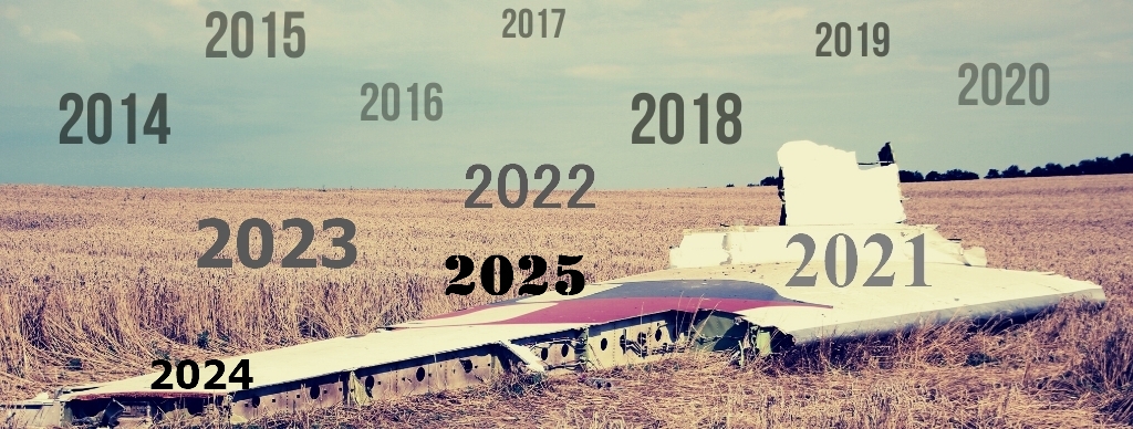
Het bewerkstelligen van waarheidsvinding, gerechtigheid en rekenschap voor het neerhalen van vlucht MH17 blijft voor het kabinet de hoogste prioriteit en de inzet onverminderd groot. De afgelopen jaren zijn hiertoe verschillende stappen op diverse sporen gezet. Om de inzet voor een breed publiek inzichtelijk te maken, is een interactief overzicht in tijd opgesteld in het Nederlands en Engels (MH17tijdlijn.nl). Een PDF-versie hiervan treft uw Kamer bijgevoegd aan.
De Minister van Buitenlandse Zaken,
Stef Blok

Èññëåäîâàíèå âîïðîñà î çàêðûòèè ÂÏ íàä Óêðàèíîé è ó åå ãðàíèö ñî ñòîðîíû ÐÔ (???)

ïîðó÷åíî íåçàâèñèìîé, ìåæäóíàðîäíîé è áåñïðèñòðàñòíîé íåêîììåð÷åñêîé îðãàíèçàöèè

The Flight Safety Foundation

2

5 ôåâðàëÿ. https://www.tweedekamer.nl/kamerstukken … 2021D05417

Îòâåò íà âûïîëíåíèå ïðåäëîæåíèÿ äåïóòàòà Âàí Äàìà è äð. Î äîïîëíèòåëüíîì ôàêòè÷åñêîì ðàññëåäîâàíèè çàêðûòèÿ âîçäóøíîãî ïðîñòðàíñòâà íàä Âîñòî÷íîé Óêðàèíîé è âîêðóã íåå (Ïàðëàìåíòñêèé äîêóìåíò 33997-145)
Ñêà÷àòü

Aan de Voorzitter van de
Tweede Kamer der Staten-Generaal
Binnenhof 4
Den Haag
Datum 5 februari 2021
Betreft Uitvoering motie van DAM c.s. – aanvullend feitelijk onderzoek naar het sluiten van het luchtruim boven en rondom Oost-Oekraïne

Geachte voorzitter,

Hierbij informeer ik uw Kamer, mede namens de Minister van Justitie en Veiligheid, over de uitvoering van de motie van Dam c.s., ingediend op 1 oktober 2019, waarin de regering wordt verzocht te inventariseren welke opties er zijn om tot een vollediger nader feitenonderzoek te komen inzake de sluiting van het luchtruim boven en rondom het oosten van Oekraïne en de Kamer daarover te informeren (Kamerstuk 33997, nr. 145). Als bijlage bij deze Kamerbrief treft u het eindrapport aan van het in dit kader door de Flight Safety Foundation uitgevoerde nader feitenonderzoek, alsmede een door het Ministerie van Buitenlandse Zaken aangeboden Nederlandse vertaling van de managementsamenvatting van dit eindrapport. In voorliggende brief volgt eveneens een appreciatie van het kabinet.

Inleiding
Allereerst spreekt het kabinet zijn waardering uit voor dit veelomvattende en zorgvuldig opgestelde rapport. Het kabinet is van mening dat dit rapport een bijdrage levert aan het inzichtelijk maken van de praktijk van staten ten aanzien van het sluiten van het luchtruim boven conflictgebieden, alsmede specifiek de feitelijke omstandigheden met betrekking tot de sluiting van het luchtruim boven en rondom het oosten van Oekraïne voorafgaand aan en ten tijde van het neerhalen van vlucht MH17. Dit rapport vormt daarmee een waardevolle aanvulling op het onderzoek van de Onderzoeksraad voor Veiligheid (OVV, 13 oktober 2015) naar de oorzaken van de crash van vlucht MH17, waarin het sluiten van het luchtruim boven het oosten van Oekraïne ook aan de orde komt.

Bevindingen en appreciatie per deelonderwerp
Zoals aangegeven in de Kamerbrief van 1 mei 2020 (Kamerstuk 33997, nr. 152.   d.d. 1 mei 2020) is het aanvullend feitelijk onderzoek uitgevoerd aan de hand van drie deelonderwerpen. Per deelonderwerp volgt hieronder een korte appreciatie namens het kabinet.

i) Een representatieve inventarisatie van de praktijk van staten ten aanzien van het gebruik van vliegroutes door de burgerluchtvaart boven conflictzones in de afgelopen 20-30 jaar

De Flight Safety Foundation heeft, over de periode van 1985-2020, 34 casussen van het neerhalen van burgerluchtvaarttuigen boven conflictgebieden nader geanalyseerd. Op basis van deze analyses stelt het rapport dat er geen gangbare praktijk van staten blijkt te zijn om het luchtruim boven conflictgebieden volledig te sluiten. Zoals ook al eerder geconcludeerd naar aanleiding van rapporten van de OVV, benadrukt deze constatering opnieuw het belang van de voortdurende inzet van Nederland en de gehele internationale gemeenschap voor het verbeteren van de veiligheid van de burgerluchtvaart als het gaat om vliegen boven conflictgebieden. Nederland blijft zich hier ook in de toekomst voor inspannen, onder andere door een actieve rol binnen de ICAO en de EU, en als medeoprichter van de Safer Skies Consultative Committee, voortkomend uit het door Nederland gesteunde Canadese Safer Skies Initiatief.

ii) Een feitelijk onderzoek naar de sluiting van het luchtruim boven het oosten van Oekraïne vanaf 1 maart 2014 tot de volledige sluiting daarvan na het neerhalen van vlucht MH17 op 17 juli 2014

Het rapport stelt dat, op basis van de beschikbare informatie, waaronder de informatie die in het kader van het onderzoek door de Oekraïense autoriteiten is aangeleverd, onvoldoende feiten zijn vastgesteld die er op duiden dat de Oekraïense autoriteiten die destijds verantwoordelijk waren voor de veiligheid van de burgerluchtvaart boven het oosten van Oekraïne zich bewust waren van een bedreiging voor de burgerluchtvaart boven dat deel van het luchtruim dat al was gesloten of zich daar bewust van hadden kunnen zijn. Op basis van deze bevindingen ziet het kabinet geen aanleiding om het eerdere standpunt van het kabinet (Kamerstuk 33997, nr. 137, d.d. 2 mei 2019) te heroverwegen, namelijk dat er op dit moment geen voldoende overtuigend juridisch bewijs is voor een succesvolle aansprakelijkstelling van Oekraïne voor het niet volledig sluiten van het luchtruim.

iii) Een feitelijk onderzoek naar de sluiting van het luchtruim boven het grondgebied van de Russische Federatie grenzend aan het oosten van Oekraïne vanaf 1 maart 2014 tot de volledige sluiting daarvan na het neerhalen van vlucht MH17 op 17 juli 2014

Op basis van de beschikbare informatie, waaronder de informatie die in het kader van het onderzoek door de Russische autoriteiten is aangeleverd, stelt het rapport dat er ook onvoldoende feiten zijn vastgesteld die er op duiden dat de Russische autoriteiten die destijds verantwoordelijk waren voor de veiligheid van de burgerluchtvaart boven het aangrenzende Russische grondgebied zich bewust waren van een bedreiging van de burgerluchtvaart boven dat deel van het luchtruim dat al was gesloten of zich daar bewust van hadden kunnen zijn. Het kabinet benadrukt dat de bevindingen van het onderzoek niet van invloed zijn op het eerdere standpunt van het kabinet (Kamerstuk 33997, nr. 117, d.d. 25 mei 2018), namelijk dat de Russische Federatie aansprakelijk is voor het neerhalen van vlucht MH17.

Medewerking Rusland en Oekraïne
Zoals reeds genoemd in het plenaire debat met uw Kamer op 1 oktober 2019 was de medewerking van Oekraïne en de Russische Federatie noodzakelijk voor de uitvoering van het door uw Kamer verzochte feitenonderzoek. Via diplomatieke kanalen, evenals via de Minister van Buitenlandse Zaken, is meermaals contact geweest met zowel de Russische Federatie als Oekraïne over de uitvoering van het onderzoek en hierbij is steeds het belang van medewerking benadrukt. De totstandkoming van deze medewerking bleek in de praktijk langer te duren dan voorzien. De antwoorden van zowel Oekraïne als Rusland op de vragen van de Flight Safety Foundation zijn opgenomen in bijlagen bij het rapport. Het rapport zal ook worden overhandigd aan de Oekraïense en Russische ambassadeurs.

Ten slotte
Ten slotte hecht het kabinet eraan opnieuw te benadrukken dat waarheidsvinding, gerechtigheid en rekenschap voor de 298 slachtoffers van het neerhalen van vlucht MH17 en hun nabestaanden voor het kabinet prioriteit is en blijft.

De minister van Buitenlandse Zaken,


Stef Blok
[Ondertekenaar 2]


[Ondertekenaar 3]

[Ondertekenaar 4]

3

Factual inquiry into the airspace closureabove and around eastern Ukraine in relation to the downing of Flight MH17
Flight Safety Foundation
JANUARY 2021

Table of Contents
About Flight Safety Foundation ........................................................................................................................................................ 1
Executive Summary.......................................................................................................................................................................... 2
Purpose ......................................................................................................................................................................................................... 2
Background ................................................................................................................................................................................................... 2
Scope............................................................................................................................................................................................................. 2
Inquiry Limitations ........................................................................................................................................................................................ 3
Hostile Events Analysis: 1985–2020 .............................................................................................................................................................. 4
Conflict Zones Analysis: 1990–2014 .............................................................................................................................................................. 5
Airspace Restrictions Over and Around Eastern Ukraine................................................................................................................................. 7
Collecting Information About Ukraine and Russian Federation Threat Awareness ......................................................................................... 8
Ukraine Awareness of Threat to Civil Aircraft................................................................................................................................................ 10
Russian Federation Awareness of Threat to Civil Aircraft .............................................................................................................................. 12
1. Introduction............................................................................................................................................................................14
1.1. Purpose................................................................................................................................................................................................ 14
1.2. Background.......................................................................................................................................................................................... 14
1.3. Scope ................................................................................................................................................................................................... 15
1.4. Inquiry Limitations............................................................................................................................................................................... 15
1.5. Definitions ........................................................................................................................................................................................... 16
2. Overall Framework ..................................................................................................................................................................17
3. Hostile Events Analysis: 1985–2020 .........................................................................................................................................19
3.1. Purpose of the Hostile Events Analysis ................................................................................................................................................. 19
3.2. Hostile Events Sample.......................................................................................................................................................................... 20
3.3. Airspace Restrictions and Hostile Events .............................................................................................................................................. 20
3.4. Targeted Aircraft .................................................................................................................................................................................. 20
3.5. Capability to Attack.............................................................................................................................................................................. 25
3.6. Risk and Capability Engagement Altitude ............................................................................................................................................ 26
3.7. Intentional vs. Unintentional Attack..................................................................................................................................................... 27
3.8. Hostile Events and Conflict Zone Flights ............................................................................................................................................... 27
4. Conflict Zones Analysis: 1990–2014..........................................................................................................................................28
4.1. Purpose of the Conflict Zones Analysis ................................................................................................................................................. 28
4.2. Conflict Zones Sample .......................................................................................................................................................................... 28
4.3. Conflict Zone Indicators........................................................................................................................................................................ 28
4.4. Overview of the Conflict Zone Analysis................................................................................................................................................. 30
4.5. Discussion of the Conflict Zone Analysis ............................................................................................................................................... 32
5. Airspace Restrictions Over and Around Eastern Ukraine.............................................................................................................34
5.1. Objectives of the Airspace Restrictions Analysis ................................................................................................................................... 34
5.2. Scope of the Airspace Restrictions Analysis .......................................................................................................................................... 34
5.3. Technical Background........................................................................................................................................................................... 34
5.3.1. Background .............................................................................................................................................................................. 34
5.3.2. Airspace Sovereignty, FIRs and ATS Routes ............................................................................................................................... 34


1

4

5.3.3. Airspace Restrictions................................................................................................................................................................. 34
5.3.4. NOTAM...................................................................................................................................................................................... 35
5.4. Analysis of the NOTAMs........................................................................................................................................................................ 36
5.5. Adopted Format for NOTAM Description............................................................................................................................................... 36
5.6. Ukraine Airspace Restrictions Timeline................................................................................................................................................. 37
5.6.1. NOTAM A0820/14, Issued on 24 April 2014............................................................................................................................... 37
5.6.2. NOTAM A0942/14, Issued on 05 May 2014 ............................................................................................................................... 38
5.6.3. NOTAM A1219/14, Issued on 02 June 2014............................................................................................................................... 39
5.6.4. NOTAM A1229/14, Issued on 03 June 2014............................................................................................................................... 40
5.6.5. NOTAM A1231/14, Issued on 04 June 2014............................................................................................................................... 41
5.6.6. NOTAM A1234/14, Issued on 04 June 2014............................................................................................................................... 42
5.6.7. NOTAM A1236/14, Issued on 04 June 2014............................................................................................................................... 43
5.6.8. NOTAM A1255/14, Issued on 05 June 2014............................................................................................................................... 44
5.6.9. NOTAM A1256/14, Issued on 05 June 2014............................................................................................................................... 45
5.6.10.NOTAM A1383/14, Issued on 26 June 2014............................................................................................................................... 46
5.6.11.NOTAM A1384/14, Issued on 26 June 2014............................................................................................................................... 47
5.6.12.NOTAM A1492/14, Issued on 14 July 2014 ................................................................................................................................ 48
5.6.13.NOTAM A1493/14, Issued on 14 July 2014 ................................................................................................................................ 49
5.6.14.NOTAM A1507/14, Issued on 17 July 2014 after the Downing of Flight MH17 .......................................................................... 50
5.6.15.NOTAM A1517/14, Issued on 17 July 2014 after the Downing of Flight MH17 .......................................................................... 51
5.7. Russian Federation Airspace Restrictions Timeline ............................................................................................................................... 52
5.7.1. NOTAM V6158/14, Issued on 17 July 2014 ................................................................................................................................ 52
5.7.2. NOTAM A2681/14, Issued on 16 July 2014 ................................................................................................................................ 54
5.8. Summary of the Airspace Restriction Timeline Prior to the Downing of Flight MH17 ........................................................................... 55
6. Collecting and Analysing Information About Ukraine and Russian Federation Threat Awareness ................................................58
6.1. Information Collection Framework....................................................................................................................................................... 58
6.2. Public Information Collection and Analysis .......................................................................................................................................... 59
6.2.1. Objective, Process and Structure............................................................................................................................................... 59
6.2.2. Sources of Information ............................................................................................................................................................. 59
6.2.3. Findings and Analysis: Publicly Available Conflict Information ................................................................................................. 59
6.2.4. Statements from Ukraine and the Russian Federation .............................................................................................................. 61
6.2.5. Presence of Air Defence Systems in Eastern Ukraine ................................................................................................................. 63
6.2.6. Post Flight MH17 Assessments ................................................................................................................................................. 65
6.3. Standard Procedures Questionnaire ..................................................................................................................................................... 67
6.4. Threat Knowledge Questionnaire ......................................................................................................................................................... 69
6.5. Inquiry Into Ukraine Standard Procedures and Threat Knowledge........................................................................................................ 70
6.6. Inquiry into Russian Federation Standard Procedures and Threat Knowledge ...................................................................................... 75
7. Discussion on Ukraine and Russian Federation Threat Awareness ..............................................................................................80
7.1. Discussion Framework.......................................................................................................................................................................... 80
7.2. Risk Analysis and Decision-Making Responsibilities............................................................................................................................. 80
7.3. Risk Assessment................................................................................................................................................................................... 81
7.4. Ukraine Awareness of Threat to Civil Aircraft ........................................................................................................................................ 84
7.5. Russian Federation Awareness of Threat to Civil Aircraft....................................................................................................................... 85


2

5

Appendix A Conflict zones case studies.............................................................................................................................................87
Bosnian war 1992–1997 ............................................................................................................................................................................. 87
Croatian war 1991–1995............................................................................................................................................................................. 90
Democratic Republic of the Congo (DRC) ..................................................................................................................................................... 93
Egypt (Sinai)................................................................................................................................................................................................ 95
Georgia-Russia 2008.................................................................................................................................................................................... 98
Iraq war 1991 ............................................................................................................................................................................................ 101
Iraq war 2003–2011.................................................................................................................................................................................. 104
Kosovo–Allied Force 1999 ......................................................................................................................................................................... 107
Libya 2011................................................................................................................................................................................................. 110
Slovenia 1991 ............................................................................................................................................................................................ 113
Afghanistan 2001–present........................................................................................................................................................................ 116
Armenia Azerbaijan................................................................................................................................................................................... 119
Ivory Coast 2002–2004.............................................................................................................................................................................. 122
Indonesia (Aceh) 1990–1998 .................................................................................................................................................................... 125
Mali 2012–2015........................................................................................................................................................................................ 128
Georgian Civil Wars 1991–1993................................................................................................................................................................. 132
Appendix B Questionnaire Responses: Russian Federation standard procedures and threat knowledge............................................134
Appendix C Clarifying Questions Responses from Russian Federation ..............................................................................................150
Appendix D Questionnaire Responses: Ukraine standard procedures and threat knowledge.............................................................153
Appendix E Clarifying Questions Responses from Ukraine ...............................................................................................................169
References ....................................................................................................................................................................................171


3

6

ñòð. 1.
About Flight Safety Foundation
Flight Safety Foundation is an independent, nonprofit, international organization exclusively chartered to provide impartial research, education, advocacy, and
communications in the field of aviation safety. Founded in
1947, the Foundation brings together aviation professionals from all sectors to help solve safety problems facing
the industry. With membership throughout the world, the
Foundation brings an international perspective to aviation
issues for its members, the media and the traveling public.
The Foundation is in a unique position to identify
global safety issues, set priorities and serve as a catalyst to
address these concerns through data collection and information sharing, training, safety standards, best practices
and toolkits. The Foundation strives to bridge proprietary,
cultural and political differences in the common cause of
advancing global aviation.
Many of the safety issues the Foundation has addressed
over the decades have evolved as air travel has grown and
technology and training have improved. The stellar safety
record of the aviation industry speaks to the progress that
has been made.
One of the issues that the Foundation has focused on
involves the risk to airliners that fly over conflict zones.
Threats to commercial aviation due to hostile activity
in conflict regions around the world are a continuing
concern. In 2020, there were two such occurrences. On 8
January 2020, Ukraine International Airlines Flight 752
was shot down shortly after takeoff from Tehran Imam
Khomeini International Airport, resulting in 176 fatalities.
On 4 May 2020, an East African Express Airways aircraft
was shot down on approach to Berdale airport in Somalia,
resulting in six fatalities.
The Foundation has long been involved in working
to mitigate civil aviation conflict zone risk. In August
2014, just weeks after the downing of Malaysia Airlines
Flight MH17 over eastern Ukraine, the Foundation’s chairman was chosen to lead the International Civil Aviation
Organization’s (ICAO) Task Force on Risks to Civil Aviation
Arising from Conflict Zones. The ICAO Task Force produced important recommendations to mitigate the risks
to civil aviation which were incorporated into ICAO’s Risk
Assessment Manual for Civil Aircraft Operations Over and
Near Conflict Zones.
The Foundation continues its global campaign on
heightened awareness of, and action on, conflict zone risk
to civil aviation. Within the context of a still-prominent
risk, this report attempts to advance the understanding of
risk assessment of attacks from the ground on civil aircraft
and on the state processes for integrated airspace security
risk assessment.
Flight Safety Foundation
Headquarters
701 N. Fairfax Street, Suite 250
Alexandria, VA 22314 USA
Tel. +1 703.739.6700
flightsafety.org
Flight Safety Foundation
European Regional Office
Rue de la Fuseé, 96
B-1130 Brussels, Belgium
Flight Safety Foundat

7

Ñòð. 2
Executive Summary


Purpose
Flight Safety Foundation (the Foundation) conducted an
inquiry into the circumstances that led to a partial closure
of the airspace above and adjacent to eastern Ukraine in
the three-month period prior to the 17 July 2014 shootdown of Malaysia Airlines Flight MH17.
The intent of the inquiry was to analyse airspace closure
decisions made by authorities in both Ukraine and the
Russian Federation, and to understand the processes
used in making those decisions as well as the information
on which the decisions were based. The elements of the
inquiry are defined further in the Scope.
Background
On 17 July 2014, Flight MH17, flying from Amsterdam to
Kuala Lumpur, was downed over eastern Ukraine, where,
at the time, an armed conflict was taking place. Tragically,
all 298 passengers and crew lost their lives. While there
were other losses of airliners as a result of military conflict
over the previous decades, the loss of Flight MH17 constituted a watershed moment that galvanized the international community to proactively address the continuing
threat to civil aviation arising from conflict zones.
In July 2014, the United Nations Security Council adopted a resolution related to the downing of
Flight MH17. This was followed by an International Civil
Aviation Organization (ICAO) State letter, issued to draw
the attention of ICAO Member States to the international
provisions specifying state responsibilities with respect
to the safety and security of civil aircraft operating in
airspace affected by conflict.
ICAO established a senior-level Task Force to address
issues related to the safety and security of civil aircraft
operating in airspace affected by conflict. The chairman
of the Foundation’s Board of Governors was elected as the
chairman of the Task Force. The Task Force developed
a report, which included recommendations to address
the threat of military conflict to civil aviation. It urged

the international community to implement protocols to
prevent similar events from happening. These recommendations included threat assessment, sharing of threat
information, and timely and effective management of
aircraft operations and airspace.
The 36-state ICAO Council reviewed the report of the
Task Force and in October 2014, approved the conflict
zone work program. The Council also unanimously
adopted a resolution condemning the downing of Malaysia Airlines Flight MH17 over eastern Ukraine.
The technical investigation into the causes of the
Flight MH17 crash was conducted by the Dutch Safety
Board (DSB) after Ukraine delegated this authority to the
Netherlands. The report of the DSB aimed at answering
four key questions:
• What caused the crash of Flight MH17?
• How and why were decisions made to use
Flight MH17’s flight route?
• How is the decision-making process related to flying
over conflict zones generally organized?
• What lessons can be learned from the investigation
to improve flight safety and security?
The final report by the DSB was published on 13 October
2015.
Foundation research builds upon the information
contained in the DSB’s report and attempts to enlarge the
scope and deepen understanding of the factual circumstances underlying the airspace restrictions both above the
territory of Ukraine and above the territory of the Russian
Federation.
Scope
This inquiry is focused on the factual circumstances
surrounding the decision-making regarding the closure of
airspace above and around eastern Ukraine from 1 March
2014 up to and including the moment of complete closure

8

Ñòð. 3


1 As described in ICAO “Air Traffic Services Planning Manual”
2 As used in ICAO “Aeronautical Information Services Manual

of that airspace after the downing of Flight MH17 on 17
July 2014. In addition, this inquiry will provide contextual
background, through a representative inventory of state
practices 20 to 30 years prior to 2014, regarding the use by
civil aviation of airspace above conflict zones.
This inquiry was conducted from April 2020 to January 2021.
The scope of the inquiry did not include drawing
(normative) conclusions on the question of whether, prior
to the moment of the downing of Flight MH17, responsible authorities did or did not take adequate measures to
prevent the downing of the aircraft.
The following elements were covered within the scope
of the inquiry:
• A study of previous hostile events and state practice
in regard to the use by civil aviation of airspace above
conflict zones.
• An inquiry into the facts concerning the closure
of airspace above eastern Ukraine as of 1 March
2014 up to and including the moment of complete
closure of that airspace subsequent to the downing of
Flight MH17 on 17 July 2014.
• An inquiry into the facts concerning the closure of
airspace above the territory of the Russian Federation bordering eastern Ukraine as of 1 March
2014 up to and including the moment of complete
closure of that airspace subsequent to the downing of
Flight MH17 on 17 July 2014.
In this report, in accordance with ICAO and the other
referenced sources, the terms “airspace restriction”1 and
“airspace closure”2 are used interchangeably. Wherever
applicable, these terms are used with the addition of their
vertical limits.
Inquiry Limitations
There are a number of limitations associated with carrying
out this inquiry that should be considered. The limitations
are related to the characteristics of the scope, purpose, and
approach to the inquiry and to the sources and quality of
information available for use in the inquiry. Readers of the
report should keep in mind the following:
• The findings about airspace closure decisions in
Ukraine and the Russian Federation are based on
two specific sources of information: (a) public source
information available during 2020 discovered by
the Foundation and (b) information received by the
Foundation from Ukraine and the Russian Federation through responses to questionnaires. Other
sources of information, such as private sources and

information from intelligence services, were not
available for the inquiry.
• The findings from the hostile events analysis and
from the historical conflict zones analysis are based
on the information discovered by the Foundation
from public sources.
• The inquiry into airspace closure decisions in
Ukraine and the Russian Federation is focused on
information about: (a) the threat awareness of the
authorities responsible for airspace security risk
analysis and decision-making and not about the
potential threat awareness of other entities within
each government, and (b) facts reported publicly by
organisations and authorities and does not include
conclusions and inferences from these facts made by
organisations and authorities.
• The inquiry was carried out remotely due to COVID-19 travel restrictions. The Foundation requested
access to engage directly with identified relevant authorities and specialists in Ukraine and the Russian
Federation, which would have been possible through
teleconferencing or video conferencing. Ultimately,
Ukraine and the Russian Federation preferred providing information through written questionnaires
developed by the Foundation. Information was
transmitted via the respective diplomatic channels.
The Foundation does not have visibility on how the
information was collected and processed within the
relevant authorities in the two countries.
• The process of sending questionnaires, waiting for
the written responses and then processing those responses took considerable time and limited the number of iterations to two — the first set of questions
to each state and then a set of clarifying questions to
each. These circumstances limited the depth of the
inquiry.
• While the findings about airspace closure decisions
in Ukraine and the Russian Federation and the findings from the historical conflict zones analysis are
for the defined time periods ending on 17 July 2014,
numerous changes have been implemented since
then, including changes initiated by ICAO, sovereign
states, aviation authorities, airlines, and air navigation service providers. The findings are not directly
transferable to the current practices.
• Because six years have passed since the downing
of Flight MH17, it is more challenging to obtain
information on procedures, decisions and practices in place at the time in 2014. Key personnel and
decision makers who were in place in 2014 may not

9

Ñòð.4

be in place now. We do not have independent verification about whether our questions were answered
by people knowledgeable about the decision-making
processes and practices in place prior to the downing
of Flight MH17.
Hostile Events Analysis: 1985–2020
At the outset of the project, the Foundation gathered and
analysed data on 57 hostile events involving civil aviation in and around conflict zones over a 35-year period
beginning in 1985. The period was selected based on the
information for the hostile events that the Foundation was
able to collect. Included in the sample were intentional
and unintentional attacks from the ground on commercial air transport and general aviation operations. Hostile
events, as illustrated in Figure 1, are the intentional or
unintentional engagement of a capability to attack3 against
civil aviation.
Hostile events are “the tip of the iceberg,” and for each
hostile event that occurred, there were many more precursor situations that sometimes were and sometimes were
not associated with a conflict zone (for example, a terrorist
act not in a conflict zone).
In order to study the conflict zones, it is necessary to
study their potential worst outcome — hostile events.
Additionally, considering that most hostile events are associated with flights in nonrestricted airspace, this part of
the inquiry was an important source of information about
the failure of state practices to restrict the airspace.
The results of the hostile events analysis show that most
hostile events took place over conflict zones when the
airspace was not restricted

Finding 1: Foundation analysis shows that most of the
hostile events involving surface-to-air attacks against
civil aviation flights that took place during the period
of 1985‒2020 could have been prevented by restricting
the airspace above or around the conflict zone and by
adherence to the restrictions.
The Foundation’s research showed that man-portable air
defence systems, or MANPADS, usually relatively small,
shoulder-launched weapons capable of reaching 15,000 ft,
are the most common weapon used against civil aviation.
(See, in Figure 2 (p. 5), the number of events in the sample
associated with a given capability to attack.) MANPADS
generally are easier to obtain and use than larger,
non-man-portable surface-to-air missile (SAM) systems,
which are technically more complex, more difficult to operate and can reach targets at much higher altitudes.
However, the size of most MANPADS warheads (less
than 2 kg [4 lb] for some common MANPADS) means that
a catastrophic outcome — i.e., the aircraft being shot down
— is not certain. By comparison, the SAM events identified
show that a catastrophic outcome from a successful attack
is highly probable, at least in part because of the larger warhead (as much as 70 kg [154 lb] in some missiles).
Finding 2: Based on an analysis of reported surface-toair attacks against civil aviation flights for the period of
1985‒2020, MANPADS are the most common weapon
used against civil aviation. MANPADS are generally
easier to obtain and use than larger, non-portable SAM
systems. However, the size of most MANPADS warheads means that a catastrophic outcome is not certain.
By comparison, the SAM events identified show that a

Figure 1
Hostile Events Pyramid
https://d.radikal.ru/d30/2102/6c/43c154498df4.jpg

òåêñò

Hostile events
Capability and
intent to attack
Capability and
factors for an
unintentional attack
Situations or zones with capability to
attack aircraft in  ight


3 -  E.g., MANPADS or surface-to-air missiles

10

Ñòð.5
Figure 2
Number of Events in the Sample Associated With a Given Capacity to Attack
https://a.radikal.ru/a09/2102/b1/554a8c73c66d.jpg

catastrophic outcome from an effective attack is highly
probable. The presence of SAMs should therefore be a
key indicator in any airspace risk analysis and avoid/
overfly decision.
Information about the engagement altitude was found in
34 of the 57 hostile events in the Foundation’s “Hostile
Events in Civil Aviation” database. Four of the events
occurred above Flight Level (FL) 250 and 19 occurred below FL 50. Five occurrences, which are depicted in red in
Figure 3 (p. 6), were identified as involving a SAM attack.
The occurrences depicted in blue involved a capability to
attack other than a SAM.
Table 1 (p. 6) presents information about unintentional
attack occurrences extracted from the Foundation database. There are eight such events identified and all but one
involved military misidentification of the target’s identity
and/or intentions. The remaining 49 events involved either an intentional attack or events for which the Foundation did not find information regarding intent.
Conflict Zones Analysis: 1990–2014
Apart from hostile events, the Foundation built an inventory of state practices up to 25 years prior to 2014 regarding the use by civil aviation of airspace above conflict
zones. Among other things, the Foundation focused on
determining the presence of air defence equipment (both
air-to-air and surface-to-air) during a conflict and the
restrictions applicable to the use of the airspace.
Within the context of this study, the purpose of the
conflict zones analysis was to set data-defined context for


4 25,000 ft (7,600 m)

other research components by providing an overview of
state practices regarding airspace restrictions above and/or
around conflict zones.
Conflict zones were selected by choosing those cases in
which security risk for civil aircraft above FL 2504 could
be reasonably expected. This was determined by the
overall objective of the inquiry, which focuses on threats
to civil aviation above airspace that was already closed to
civil aviation in Ukraine and the Russian Federation prior
to the downing of Flight MH17 and above the altitude
where MANPADS can pose a risk.
In total, 16 conflict zones were selected, based on the
information available for the studied period and where
there was a reasonable expectation, prior to commencing
the analysis, of the existence of capability to attack at
altitudes above FL 250. The selected conflict zones were
reviewed relative to a set of 10 pre-determined “indicators of likelihood of attack,” such as the capability to attack a target in flight above FL 250 (e.g., the presence of
surface-to-air missiles), the known intent to attack and
the missile operators’ experience and chain of command.
For each of the 16 selected conflict zones, the Foundation researched the actual airspace restrictions and used
proprietary risk analysis algorithms to assess the overall
likelihood of attack on civil aircraft. The intent was to
set data-defined context for other research components
by providing an overview of state practices regarding
airspace restrictions above and/or around conflict zones.
The results of the analysis are summarised in Table 4
(p. 31) of the report.

11

Ñòð.6
Figure 3
Altitude Distribution
https://d.radikal.ru/d05/2102/d0/76d065f99ab6.jpg

Table 1
Unintentional Acts and Their Context

Date

State

Unintentional Act

Aircraft
Operator

Perpetrator

Altitude

Killed/Injured/
Uninjured

11-Jun-87

Afghanistan

Misidentified as a Russian IL14.

Bakhtar Afghan

Hezb-i-Islami

n/k

53/2/0

03-Jul-88

Iran

Military misidentified target as a
descending Iranian F-14.

Iran Air

U.S. Navy

13,500 ft

290/0/0

29-Aug-99

Ethiopia

Military targeting error after proceeding
into NOTAM closed airspace

Corporate Jets

Ethiopian Army

FL 410

2/0/0

04-Oct-01

Black Sea

Military exercise missile overshot intended target at 18
nm (33 km) by 140 nm (259 km) after locking onto it.

Sibir Airlines

Ukraine Armed
Forces

FL 360

78/0/0

26-Jan-15

Iraq

Probably accidental, rounds
from nearby social event.

FlyDubai

n/k

<2,000 ft

0/2/X

08-Jan-20

Iran

Military misidentified aircraft as
a hostile target.

Ukraine
International

Iranian Armed
Forces

8,100 ft

176/0/0

04-May-20

Somalia

Military misidentified going-around
aircraft as a suicide plane.

Ethiopian troops as
part of AMISOM

2.230 ft

6/0/0

25-May-20

Somalia

Military misidentified aircraft
and opened fire

Aeronav/Kenya
School of Flying

Ethiopian troops as
part of AMISOM

<1,200 ft

0/0/X

AMISOM = African Union Mission to Somalia; FL = Flight Level; n/k = not known; NOTAM = notice to airmen

12

Ñòð. 7

The Foundation concluded that restricting the airspace
above conflict zones is a very effective measure to reduce
the assessed likelihood of attack against civil flights. As
illustrated in Figure 4, in the studied sample, there were
eight cases in which an entity (the sovereign state or a
third party) introduced partial or full airspace restrictions.
This comparative assessment of likelihood of attack with
and without airspace restrictions reveals that in six of the
eight cases where airspace restrictions were introduced,
the assessed likelihood of attack against civil aviation was
reduced considerably.
However, the Foundation did not find a uniform practice of states closing their own airspace when there were
indications of a likelihood of attack against civil aircraft. Of
the 16 studied conflict zones, there were only two instances
in which the sovereign state responsible for that airspace
completely closed its own airspace (Figure 5).
Finding 3: The analysis of selected conflict zones over the
period of 1990‒2014 did not identify a uniform practice
of states closing their own airspace when there were
indications of a likelihood of attack against civil aircraft
in the context of an armed conflict on the territory of
that state.
Finding 4: The analysis of selected conflict zones over
the period of 1990‒2014 identified that, on the rare
occasions when a state restricted its own airspace above
FL 250, it was associated with the loss of effective control over the relevant airspace by the state.
Also, when a state does restrict its own airspace above
FL 250, or such a restriction is imposed by a third party
(such as in the introduction of a “no fly zone” by an
entity like the North Atlantic Treaty Organization), the

predominant concerns are the security of military operations and of the population rather than the security of
civil aviation.
Finding 5: The analysis of selected conflict zones over
the period of 1990‒2014 identified that whenever a
state closed or restricted its own airspace above FL 250,
or such a restriction was imposed by a third party, the
predominant concerns were the security of military operations and of the population rather than the security
of civil aviation.
Airspace Restrictions Over and Around Eastern Ukraine
After setting the wider background of the inquiry by characterising the historical occurrences of hostile events and
the state practices of airspace management over conflict
zones, the Foundation focused on airspace restrictions in
Ukraine and the Russian Federation immediately prior to
the downing of Flight MH17. The Foundation considered
studying the airspace restrictions timeline and specifics to
be important because restrictions are the main outcome of
airspace restrictions decision-making, which is the focus
of this inquiry.
Both Ukraine and the Russian Federation introduced
restrictions on the airspace above and around eastern
Ukraine, but neither state completely closed its airspace
above or near the conflict zone before the downing of
Flight MH17. The airspace in question was first restricted
up to FL 260 and subsequently, but before the downing
of Flight MH17, up to FL 320. These airspace restrictions
were promulgated with notices to airmen (NOTAMs).
The Foundation analysed 1,310 NOTAMs regarding
their relevance to the studied area and time. It selected 15
NOTAMs to be analysed in detail.

Figure 4                                                                                                                                                         Figure 5
Eight Cases of Airspace Restrictions                                                                                                                  Sample of 16 Conflict Zones
https://b.radikal.ru/b24/2102/fe/4dad6399a44f.jpg

òåêñò

Likelihood
remained low (1)
Likelihood reduced
from high to low
(6)
Figure 5
Sample of 16 Conflict Zones
Partially restricted (1)
Likelihood
remained high (1)
Airspace
restricted (2)
Others’
restrictions (5)
No restriction (8)

13

Ñòð. 8

In the NOTAMs in which Ukraine placed a partial
restriction on airspace in the Dnepropetrovsk Flight
Information Region (FIR), it did not provide any reasons
for the restriction or any reference to incidents involving
military aircraft in the airspace.
The DSB report on the crash of Flight MH17 provides
information about the reasons the Ukrainian authorities
restricted the airspace up to FL 260, promulgated with
NOTAMs A1255/14 and A1256/14, issued on 5 June 2014.
The provided reasons were not related to the security risk
from attacks from the ground to civil aircraft overflying
the area. The airspace was restricted to enable military
aeroplanes to fly at an altitude that was considered safe
from attacks from the ground and to eliminate the risk
that they would encounter civil aeroplanes, which flew
above FL 260, according to the DSB report.
The reasons the Ukrainian authorities increased the upper limit of the restricted airspace to an altitude of 32,000
ft (FL 320) were not provided in the respective NOTAMs
(A1492/14 and A1493/14). The DSB report said the reason for increasing the upper limit of the restricted airspace
“was intended to increase the altitude buffer between
military and civil aircraft.”
The Russian Federation, on the other hand, cited
international flight safety as a reason when it closed its
affected air traffic services (ATS) routes up to FL 320. In
two NOTAMs (V6158/14, A2681/14) published on 16 July
2014, the Russian Federation said that to ensure international flight safety, it was closing the ATS routes “due to
combat actions on the territory of Ukraine near the state
border with the Russian Federation and the facts of firing
from the territory of the Ukraine towards the territory of
Russian Federation.”

Prior to the downing of Flight MH17 on 17 July 2014,
the two referenced Russian Federation NOTAMs were
the only identified, specific warnings related to the
security of civil aviation in the Dnepropetrovsk and
Rostov-on-Don FIRs.
Collecting Information About Ukraine and
Russian Federation Threat Awareness
In order to discuss the airspace closure decisions made
by authorities in Ukraine and the Russian Federation, the
Foundation looked for information about the relevant
authorities’ threat awareness for the referenced airspace
that was not restricted.
The threat information is of different types. In respect
to the capability to attack, the threat information can involve what authorities said they knew about the weapons
that could pose a potential threat to civil aviation above
FL 320. Or it can consist of information about the weapons that was available in the public space, such as on social
media, without indications of whether relevant authorities
knew about it. The source of information can be traditional media and/or social media or private information from
intelligence services. These different types of information
imply different degrees of confidence about authority
awareness or the veracity of the information. For these
reasons, the threat information is categorised conceptually
in Figure 6 as follows:
• Foresight knowledge of threat information: quadrant 1. This is
information that was known prior to the downing of
Flight MH17 about the presence of weapons.
• Hindsight knowledge of threat information: quadrant 2. This is
information that was made known after the downing
of Flight MH17 about the presence of weapons. In

Figure 6
Information Collection Framework
https://d.radikal.ru/d24/2102/f7/d59ab989bf0f.jpg

òåêñò

Information published
(made available) prior to
Flight MH17 downing
What did the responsible State
(authorities) know before
Flight MH17 downing about the
presence of air defense equipment
3 Foresight knowledge of
authorities awareness
4Hindsight knowledge of
authorities awareness
Information published
(made available) after
Flight MH17 downing
Information about presence of
air defense equipement prior
to Flight MH17 downing
1 Foresight knowledge of
threat information
2 Hindsight knowledge of
threat information

14

Ñòð. 9

general, this type of information gives less confidence about potential threat awareness of relevant
authorities because it is just information about what
has been seen, heard or otherwise discovered but
made known only after the downing of Flight MH17.
• Foresight knowledge of authorities’ awareness: quadrant 3.
This is information that was known prior to the
downing of Flight MH17 about what the relevant
authorities knew about the presence of weapons.
In general, this type of information gives the most
confidence about potential threat awareness because
it is mainly self-reporting by relevant authorities
about their knowledge prior to the downing of
Flight MH17 — hence clear of any hindsight bias.
• Hindsight public knowledge of authorities’ awareness: quadrant 4.
This is information that was made known after the
downing of Flight MH17 about what the relevant
authorities knew before the downing of Flight MH17
about the presence of weapons.
With the above-described four types of information, the
Foundation looked at two main sources of information:
• Publicly available information from primarily online
media, including Ukrainian and Russian news
services and other news aggregation sites, internationally available aviation trade media, government announcements and news releases, as well as
information available on social media, including
Twitter and Facebook, and in the DSB accident
investigation report.

The responses from Ukraine and the Russian Federation to the standard procedure and threat knowledge
questionnaires that were specifically developed for
this inquiry and to the subsequent responses to some
clarifying questions. The Russian Federation and the
Ukrainian governments were approached with and
responded to the information collection template
containing the questionnaires. Following the analysis
of the information received, the Foundation concluded that there are number of questions that remain
open and formulated and received answers to some
additional clarifying questions.
To ensure a systematic coverage and a comprehensiveness
of the information collection, we identified the need to use
certain standard process descriptions when drafting the
information collection questionnaires. For that purpose,
we used the Foundation’s “best process” description that
is based on our accumulated experience and analyses up
to the moment of this inquiry. Namely, the Foundation’s
integrated standard for airspace security risk assessment,
as illustrated in Figure 7, addresses the five main functions to be assigned to one or more different authorities,
organised as an integrated process and performed within a
given sovereign state.
The Foundation standard defines a statewide process
for airspace security risk management that is distributed around different authorities and organisations, yet
functional from end to end. In this way, the organisational
scope of the process is not restricted to the more traditional perspective of civil-military aviation coordination (e.g,

Figure 7
Flight Safety Foundation Integrated Standard for Airspace Security Risk Assessment
https://b.radikal.ru/b17/2102/60/ea29ed7a6c00.jpg

Òåêñò

A.
Threat watch
B.
Threat analysis
C.
Risk analysis
D.
Decision-making
E.
Promulgation

15

Ñòð. 10
Figure 8
Criterion for Threat Awareness
https://b.radikal.ru/b27/2102/8f/c22f15c8c161.jpg

Òåêñò

Social media
Public and
private sources
Other actors’
information

Adjacent
airspace
Verifying the
information
Unintentional
attack factors

Coordination
and analysis
Potential
consequences
Risk
assessment
Risk
mitigations

Confict zone
decision
Adjacent FIR
coordination

Implement the
decision
Publish or not
and how
Special
advisories and
threat
information

Threat awareness of authorities responsible for
risk analysis and decision-making

some state intelligence functions may not be attributed to
military authorities).
Each of the five functions of the integrated standard for
airspace security risk assessment targets a particular step
from the risk assessment process and contains three or
four specific sub-functions that are formulated as questions in our questionnaires.
One important part of our inquiry was identifying when
information about the threat reaches:
• Those responsible for analysing security risk levels in
civil aviation airspace over a conflict zone; and,
• Those establishing restrictions of airspace in a conflict zone.
This is illustrated in Figure 8, which outlines the respective stages of the Foundation’s Integrated Standard for
Airspace Security Risk Assessment.5
Threat information reaching the risk analysis and decision-making steps (C and D) in the process is the Foundation’s criterion for threat awareness at the level of the
statewide process. Using this criterion, unverified social
media posts, other media reports or the potential presence
of information in intercepted but unprocessed communications do not represent sufficient facts for realistic
5 Each step in the risk assessment process is defined in Section 6.3

threat awareness. This is because verified threat awareness
is not available to those responsible for risk analysis and
decision-making.
Ukraine Awareness of Threat to Civil Aircraft
The discussion on threat awareness is twofold — a
discussion on reported threat awareness (concerning
quadrants 3 and 4 in Figure 6) and a discussion on potential threat awareness (concerning quadrants 1 and 2
in Figure 6).
The discussion on the reported threat awareness is
about what authorities said they knew about the threat
that could reach an altitude higher than FL 320. We
studied what authorities said in public (both before and
after the downing of Flight MH17) and what they said in
response to our questionnaires. This discussion is different from what information was available in the public and
private space (on social media, in other publications and
in intelligence) about a threat.
The Foundation’s research did not find any instances before (quadrant 3 in Figure 6) the downing of Flight MH17
in which Ukrainian authorities publicly acknowledged the
presence in eastern Ukraine of air defence systems capable
of reaching an altitude greater than FL 320.

16

Ñòð. 11

The Foundation identified from information made
publicly known after (quadrant 4 in Figure 6) the downing
of Flight MH17 that some Ukrainian authorities (counterintelligence services) suspected the presence of air
defence equipment that could reach high altitudes — “first
information ‘hinting’ at a Buk launcher in the possession of
the non-state forces was received on 14 July and came from
counterintelligence units.”6 This information corresponds
to Group A of the Foundation Standard, namely threat
watch, as shown in Figure 8.
However, no facts were found that this information
had been verified per the functions in Group B from the
Foundation Standard — “But we could not confirm directly
that it was Buk missile launcher that trespassed illegally
[in] Ukrainian territory.”7 Similarly, no facts were found
by the Foundation to indicate that the information was
disseminated throughout the statewide process to reach
the authorities responsible for risk assessment and decision-making regarding airspace closure.
Finding 6: This inquiry did not find sufficient facts that
Ukrainian authorities responsible for analysing security
risk levels in civil aviation airspace and those establishing restriction of airspace in a conflict zone8 were
aware of a threat to civil aviation before the downing of
Flight MH17.
The discussion of the potential threat awareness is about
what information existed in the public and private space
(social media, other publications, and intelligence sources)
about a weapon. This discussion is not about the reported
threat awareness of the relevant authorities (discussed
previously).
It is clear from publicly available information that the
conflict in eastern Ukraine was in an active combat phase
in the weeks prior to the downing of Flight MH17.
Both the Ukrainian military and armed non-state
forces were using small arms, heavy calibre machine guns,
artillery, anti-tank weapons, tanks and various air defence
systems. In addition, Ukraine was employing rotary- and
fixed-wing aircraft for transport and attack purposes;
Ukraine alleged that Russian aircraft also had been used
to attack Ukrainian aircraft. Ukraine apparently had some
success attacking non-state ground forces with aircraft and
also suffered numerous aircraft losses.
There was a widespread belief among Ukraine and
Western states that the Russian Federation was supplying

weapons, including heavy weapons, and personnel to
support armed non-state forces in the conflict area. But
as the DSB report stated: “despite the Western political and
military focus on the conflict, its escalation and its air component, none of the politicians or authorities quoted publicly
made a connection between the military developments in
the eastern part of Ukraine and risks to civil aviation.”
There were numerous reports about the presence of
heavy weapons in the region, such as tanks, MANPADS,
artillery and large calibre machine guns. However, there
were few reports in the public space about armed nonstate forces possessing weapons with a capability to attack
above FL 320.9 There are conflicting accounts relating to
the altitude of a Ukrainian An-26 when it was shot down
on 14 July, although the aircraft was thought by some to
have been brought down with a SAM system.
The most notable publicly available information about
the capability to attack at high altitudes before the downing of Flight MH17 was from social media posts about
Buk missile systems. Some of these posts were about the
movement of Buk batteries in the Russian territory bordering Ukraine and some were about Buk missile systems
being observed in eastern Ukraine a few hours before the
downing of Flight MH17. The Foundation acknowledges
that these were just a few instances of published social
media posts out of probably millions of posts made in
the region at that time. It should also be stressed that the
veracity of published social media accounts is difficult
to establish.
In addition, the Foundation did not identify any information available in the public space prior to the attack
that would have verified the reports about the capability to
attack above FL 320. The identified number of examples
of publicly available information indicating the potential
capability to attack above FL 320 were few, relative to the
volume of all the publicly available information about the
conflict zone at the time.
With hindsight, some facts made available after the
downing of Flight MH17 pointed to the possibility for
some authorities to have processed information and
understood that there may have been a threat to civil
aviation. Namely, these are the 150,000 telephone conversations10 intercepted and the counterintelligence field
information discussed previously.
However, without knowing the actual technological
capabilities and preparedness to p


6 19 July 2014 news conference featuring Vitaly Nayda, the head of counterintelligence for the Ukrainian State Security Service, https://www.youtube.com/watch?v=PWtH8AA … ture=share
7 19 July 2014 news conference featuring Vitaly Nayda, the head of counterintelligence fora the Ukrainian State Security Service https://www.youtube.com/watch?v=PWtH8AA … ture=share
8 Responsible authorities are defined in detail in Section 7.2.
9 For more details see Section 6.2.
10 On 28 September 2016, during the Joint Investigative Team (JIT) presentation of the first results of the Flight MH17 criminal investigation, it was
revealed that more than 150,000 telephone calls were intercepted.

17

Ñòð.12.

intercepted telephone conversations and social media
posts, it is not possible for the Foundation to conclude
that the Ukrainian authorities had the means to verify the
intelligence and coordinate dissemination of the information so as to form a more accurate assessment of the risk
to civil aviation and to completely close the airspace in
time to prevent the attack on Flight MH17.
Finding 7: This inquiry did not find sufficient facts that
Ukrainian authorities responsible for analysing security
risk levels in civil aviation airspace and those establishing restriction of airspace in a conflict zone11 could have
had a proper awareness of the high-altitude threat.
Russian Federation Awareness of Threat to Civil Aircraft
Some of the western part of the Rostov-on-Don FIR
airspace of the Russian Federation was in close proximity
to the conflict zone in eastern Ukraine. Because of its close
proximity to the conflict zone, the airspace could have
been affected by a threat to civil aviation originating from
a potential presence in the conflict zone of long-range air
defence equipment not controlled by government forces.
The possibility of a threat to civil aviation was acknowledged in the Russian Federation’s NOTAMs (V6158/14 and
A2681/14) closing the airspace up to FL 320. It should be
noted that an air defence equipment threat reaching FL 320
could also reach the airspace immediately above FL 320.12
The reasons for restricting their airspace, reported by
the Russian Federation in an answer to a Foundation
question, cited as a justification some statements made by
the Ministry of Foreign Affairs of the Russian Federation
prior to the Flight MH17 downing. These statements refer
to only low-altitude threats of artillery shootings.
Responding to a Foundation query regarding the reason
for selecting the upper limit for the airspace restriction,
the Russian Federation acknowledged that the airspace has
been closed up to FL 320 and that this limit was the same
as the one indicated in the Ukrainian NOTAMs A1492/14
and A1493/14 and justified the decision in the fact that
“Rosaviatsiya did not have any other, more or less credible
information provided by the Ukrainian side, which would
allow to forecast the vertical limit of the hazard zone for
civil aviation flights.”
In response to Foundation’s query on this matter, the
Russian Federation indicated that authorities did not have
any information regarding the presence of air defence
equipment in the territory of Ukraine that was not controlled by the armed forces of the Ministry of Defence of

Ukraine and that could strike targets in the Rostov-onDon FIR above FL 250.
The Foundation did not obtain satisfactory clarifications from the Russian Federation about the Russian
authorities’ knowledge of any intent to attack with air
defence equipment that was not controlled by government
forces and that could have reached the respective airspace
in Rostov-on-Don FIR above FL 250 in eastern Ukraine.
The Foundation’s research did not find any other instances in which Russian Federation authorities publicly
acknowledged before or after the downing of Flight MH17
the presence in eastern Ukraine of air defence systems
capable of reaching an altitude greater than FL 320.
Finding 8: This inquiry did not find sufficient facts that
Russian Federation authorities responsible for analysing security risk levels in civil aviation airspace and
those establishing restriction of airspace in a conflict
zone13 were aware of a threat to civil aviation before the
downing of Flight MH17.
With regards to any Russian Federation potential threat
awareness, the information identified in the public space,
and already listed in the discussion about Ukraine, was
also available to the Russian Federation, including the social media posts. However, it is assumed in this study that
the Russian Federation did not have access to intercepted
telephone conversations and intelligence information
available to the Ukrainian authorities.
Another set of facts from the public information is
associated with the Joint Investigation Team (JIT)14 that
points at a request by the non-state armed forces for a Buk
and at the transport of a Buk in the Russian Federation
and Ukraine. The JIT reported:15 “After an extensive and
labor-intensive comparative investigation, in which many
Buk-TELARs were involved, the JIT has come to the conclusion that the Buk-TELAR that shot down Flight MH17
comes from the 53rd Anti-Aircraft Missile Brigade, or the
53rd Brigade from Kursk in the Russian Federation. This
53rd Brigade is a unit of the Russian armed forces.” This
JIT conclusion has been denied by the Russian Federation.
However, the purpose of the present analysis is to identify
if the relevant authorities responsible for risk analysis and
decision-making could have had a proper threat awareness
irrespective of the origin of the weapon system. The Foundation did not identify sufficient facts to indicate that such
threat awareness existed among relevant authorities.
Apart from the discussion on the accessibility of the
information, another important aspect of the Russian


11 Responsible authorities are defined in detail in Section 7.2.
12 For example, as reported in the DSB report “The Buk surface-to-air missile system is able to engage targets at altitudes up to 70,000 or 80,000 feet.”
13 Responsible authorities are defined in detail in Section 7.2.
14 The JIT, comprised of representatives from the Netherlands, Australia, Malaysia, Belgium and Ukraine, is conducting a criminal investigation into
the crash.
15 https://www.prosecutionservice.nl/topic … -24-5-2018

18

Ñòð. 13

Federation risk analysis and decision-making can be deduced from the Russian Federation standard procedure and
decision-making protocols. In response to a Foundation inquiry relating to standard procedures and threat knowledge,
the Russian Federation stated that, “Threats to air traffic
safety in the Rostov-on-Don FIR stemmed from the dangerous activities in the area of responsibility of the adjacent Dnepropetrovsk FIR.” Further, it was also stated that “all possible
risk factors for an unintended attack should be considered”
and that “such preparations should include an assessment of
the risk to civil aircraft operations due to a military conflict or
incidents of unlawful interference with civil aviation.”
After acknowledging the source of the threat in the
neighbouring territory and, in general the need to
consider all risk factors, the Russian Federation did not

acknowledge the responsibility to determine the risk factors for an unintentional attack in Russian Federation airspace originating from the close proximity to the conflict
zone in the eastern Ukraine. With respect to the issue of
which authorities were responsible, the response was: “The
state responsible for compliance with the rules for the introduction of restrictions on the use of airspace over an armed
conflict zone (Ukraine, in relation to the MH17 crash).”
Finding 9: This inquiry did not find sufficient facts that
the Russian Federation authorities responsible for
analysing security risk levels in civil aviation airspace
and those establishing restriction of airspace in a conflict zone16 could have had a proper awareness of the
high-altitude threat.


16 Responsible authorities are defined in detail in Section 7.2.

19

Ñòð. 14
1. Introduction

1.1. Purpose
The Foundation conducted an inquiry17 into the circumstances that led to a partial closure of the airspace
above and adjacent to eastern Ukraine in the three-month
period prior to the 17 July 2014 shootdown of Malaysia
Airlines Flight MH17.
The intent of the inquiry was to analyse airspace closure
decisions made by authorities in both Ukraine and the
Russian Federation, and to understand the processes used
in making those decisions as well as the information on
which the decisions were based.
1.2. Background
On 17 July 2014, Flight MH17, flying from Amsterdam to
Kuala Lumpur, was downed over eastern Ukraine where,
at the time, an armed conflict was taking place. Tragically,
all 298 passengers and crew lost their lives. While there
have been other losses of airliners as a result of military
conflict over the previous decades, the loss of Flight MH17
constituted a watershed moment that galvanized the international community to proactively address the continuing
threat to civil aviation arising from conflict zones.
In July 2014, the United Nations Security Council adopted a resolution related to the downing of
Flight MH17. This was followed by an International Civil
Aviation Organization (ICAO) State letter, issued to draw
the attention of ICAO Member States to the international
provisions specifying state responsibilities with respect
to the safety and security of civil aircraft operating in
airspace affected by conflict.
ICAO established a senior-level Task Force to address
issues related to the safety and security of civil aircraft
operating in airspace affected by conflict. The chairman of
the Foundation’s Board of Governors was elected chairman of the Task Force. The Task Force developed a report,
which included recommendations to address the threat of
military conflict to civil aviation. It urged the international
community to implement protocols to prevent similar
events in the future. These recommendations included
threat assessment, sharing of threat information, and
timely and effective management of aircraft operations
and airspace.
The 36-state ICAO Council reviewed the report of
the Task Force and in October 2014 approved the conflict zone work program. The Council also unanimously
adopted a resolution condemning the downing of Malaysia Airlines Flight MH17 over eastern Ukraine.

The technical investigation into the causes of the
Flight MH17 crash was conducted by the Dutch Safety
Board (DSB) after Ukraine delegated this authority to the
Netherlands. The report of the DSB aimed at answering
four key questions:
• What caused the crash of Flight MH17?
• How and why were decisions made to use
Flight MH17’s flight route?
• How is the decision-making process related to flying
over conflict zones generally organized?
• What lessons can be learned from the investigation
to improve flight safety and security?
The final report by the DSB was published on 13 October
2015. With regard to the first question, the DSB determined that the cause of the crash was the detonation of
a warhead above the left side of the cockpit. The weapon
used was a 9N314M-model warhead carried on the 9M38
series of missiles, as installed on the Buk surface-to-air
(SAM) missile system.
With regard to the second question, the DSB’s report
provides an overview of the precise flight path followed by
Flight MH17 as well as the different airspace restrictions
that were imposed over time, both above the territory of
Ukraine and above the territory of the Russian Federation.
The report also provides information about possible risks
for civil aviation in those areas during the relevant period
and measures that were taken in that regard.
Foundation research builds upon the information
contained in the DSB’s report and attempts to enlarge the
scope and deepen understanding of the factual circumstances underlying the airspace restrictions both above the
territory of Ukraine and above the territory of the Russian
Federation.
Civil aviation accidents caused by attack from the ground
continue to happen. During 2020, there were two such
occurrences. On 8 January 2020, Ukraine International
Airlines Flight 752 was shot down shortly after takeoff from
Tehran Imam Khomeini International Airport, resulting
in 176 fatalities. On 4 May 2020, an East African Express
Airways aircraft was shot down on approach to Berdale
airport in Somalia, resulting in six fatalities. Threats to commercial aviation due to hostile activity in conflict regions
around the world are a continuing concern. The Foundation continues its global campaign to encourage heightened
awareness and action on this matter.

17 This inquiry was commissioned by the Ministry of Foreign Affairs of the Kingdom of the Netherlands, as announced in the letter the Ministry sent to the Netherlands’ House of Representatives om 1 May 2020: https://www.rijksoverheid.nl/documenten … 7-dossier.

20

Ñòð. 15

Within the context of a still prominent risk, this report
also attempts to advance further the understanding of risk
assessment of attack from the ground on civil aircraft and
on the state processes for integrated airspace security risk
assessment.
1.3. Scope
This inquiry is focused on the factual circumstances
surrounding the decision-making regarding the closure of
airspace above and around eastern Ukraine from 1 March
2014 up to and including the moment of complete closure
of that airspace after the downing of Flight MH17 on 17
July 2014. In addition, this inquiry will provide contextual
background, through a representative inventory of state
practices 20 to 30 years prior to 2014, regarding the use by
civil aviation of airspace above conflict zones.
This inquiry was conducted from April 2020 to January 2021.
The scope did not include drawing (normative) conclusions on the question of whether, prior to the moment of
the downing of Flight MH17, responsible authorities did
or did not take adequate measures to prevent the downing
of the aircraft.
The following elements were covered within the scope
of the inquiry:
• A study of previous hostile events and state practice
in regard to the use by civil aviation of airspace above
conflict zones.
• An inquiry into the facts concerning the closure
of airspace above eastern Ukraine as of 1 March
2014 up to and including the moment of complete
closure of that airspace subsequent to the downing of
Flight MH17 on 17 July 2014.
• An inquiry into the facts concerning the closure of
airspace above the territory of the Russian Federation bordering eastern Ukraine as of 1 March
2014 up to and including the moment of complete
closure of that airspace subsequent to the downing of
Flight MH17 on 17 July 2014.
1.4. Inquiry Limitations
There are a number of limitations associated with carrying
out this inquiry that should be considered. The limitations
are related to the characteristics of the scope, purpose, and
approach to the inquiry and to the sources and quality of
information available for use in the inquiry. Readers of the
report should keep in mind the following:
• The findings about airspace closure decisions in
Ukraine and the Russian Federation are based on
two specific sources of information: (a) public
source information available during 2020 discovered
by the Foundation and (b) information received
by the Foundation from Ukraine and the Russian

Federation through responses to questionnaires.
Other sources of information, such as private sources
and information from intelligence services, were not
available for the inquiry.
• The findings from the hostile events analysis and
from the historical conflict zones analysis are based
on the information discovered by the Foundation
from public sources.
• The inquiry into airspace closure decisions in
Ukraine and the Russian Federation is focused on
information about: (a) the threat awareness of the
authorities responsible for airspace security risk
analysis and decision-making and not about the
potential threat awareness of other entities within
each government, and (b) facts reported publicly by
organisations and authorities and does not include
conclusions and inferences from these facts made by
organisations and authorities.
• The inquiry was carried out remotely due to COVID-19 travel restrictions. The Foundation requested
access to engage directly with identified relevant authorities and specialists in Ukraine and the Russian
Federation, which would have been possible through
teleconferencing or video conferencing. Ultimately,
Ukraine and the Russian Federation preferred providing information through written questionnaires
developed by the Foundation. Information was
transmitted via the respective diplomatic channels.
The Foundation does not have visibility on how the
information was collected and processed within the
relevant authorities in the two countries.
• The process of sending questionnaires, waiting for
the written responses and then processing those responses took considerable time and limited the number of iterations to two — the first set of questions
to each state and then a set of clarifying questions to
each. These circumstances limited the depth of the
inquiry.
• While the findings about airspace closure decisions
in Ukraine and the Russian Federation and the findings from the historical conflict zones analysis are
for the defined time periods ending on 17 July 2014,
numerous changes have been implemented since
then, including changes initiated by ICAO, sovereign
states, aviation authorities, airlines, and air navigation service providers. The findings are not directly
transferable to the current practices.
• Because six years have passed since the downing
of Flight MH17, it is more challenging to obtain
information on procedures, decisions and practices in place at the time in 2014. Key personnel and
decision makers who were in place in 2014 may not

21

Ñòð. 16

be in place now. We do not have independent verification about whether our questions were answered
by people knowledgeable about the decision-making
processes and practices in place prior to the downing
of Flight MH17.
1.5. Definitions
For the purpose of this report, existing ICAO definitions
were adopted [1]. When the following terms are used in
this document, they have the following meanings:
Air-to-air missiles (AAMs) — Missiles fired at an aircraft from
another aircraft.
Civil aircraft — Non-state aircraft (pursuant to Article 3 of
the Chicago Convention). This could include passenger
airliners, cargo aircraft and business or private aircraft.
Conflict zones — Airspace over areas where armed conflict
is occurring or is likely to occur between militarized parties and is also taken to include airspace over areas where
such parties are in a heightened state of military alert or
tension, which might endanger civil aircraft.
Hazard — A condition or an object with the potential to
cause or contribute to an aircraft incident or accident.
MANPADS (man-portable air defence systems) — Shoulder-launched surface-to-air missiles. These are widely
available in many countries, particularly in conflict areas;

are portable; and can be used with relatively limited training. MANPADS are capable of bringing down aircraft, but
not of reaching cruising altitudes.
Overflying — Passing over terrestrial areas (land or sea) at
cruising altitude.
Risk — The potential for an unwanted or calculated outcome resulting from an occurrence. Risk can be estimated
by considering the likelihood of threats, vulnerabilities
and consequences or impacts.
Surface-to-air missiles (SAMs) — Any weapon that may be
fired at an aircraft from the ground (including MANPADS), but in this context, is taken to mean advanced
military equipment that is capable of attacking airborne
targets at altitudes of at least 25,000 ft.
Threat — A man-made occurrence, individual, entity or
action that has, or indicates, the potential to harm life, information, operations, the environment and/or property.
Vulnerability — Factors or attributes that render an entity, asset, system, network or geographic area open to
successful exploitation or attack or susceptible to a given
threat or hazard.
In this report, in accordance with ICAO and the other referenced sources, the terms “airspace restriction”18 and “airspace
closure”19 are used interchangeably. Wherever applicable,
these terms are used with the addition of their vertical limits.


18 As described in ICAO “Air Traffic Services Panning Manual”
19 As used in ICAO “Aeronautical Information Services Manual

22

Ñòð. 18
2. Overall Framework

The conceptual framework for this study is provided in
Figure 9 below.
The conceptual framework defines two study spaces:
risk situation and state practices. These study spaces are
described below.
Risk situation defines the objective evolution of the circumstances associated with civil aviation security or safety
risk above conflict zones. It should be noted that the ICAO
definition of conflict zones (CZ) is restrictively confined
to armed conflict that is occurring or is likely to occur
between militarized parties. The conceptual framework
acknowledges that there may be other situations (OS) that
do not fall within the ICAO CZ definition but that can
still be associated with civil aviation security threats. An
example of an OS is a situation associated with insurgents
or terrorists that is not an armed conflict.
A security threat (ST) can be associated with conflict
zones or other situations and can be assessed with the help
of the following groups of indicators:
• Capability to attack — this study will not exclude
other capabilities but will be mainly focused on the
presence of long-range SAMs and AAMs that can hit
an aircraft flying at cruising level20.
• Intent to attack — the plan for a deliberate act against
civil aviation

• Possibility of an unintentional attack — shaped by the
presence of one or more risk factors.
• Conflict parties’ command and control — the rigorousness and reliability of the command and control
procedures and practices for authorizing a capability
launch.
A security threat associated with a security risk situation
may be dormant and never materialise. Whenever it is
actively manifested, however, the security threat usually
materialises in a hostile event (HE). Hostile events are
intentional or unintentional engagement of a capability
against civil aviation. Hostile events can lead to aircraft
damage and/or injuries to flight crew and/or passengers,
but also can be inconsequential.
A hostile event and, in some instances, the actions of
the involved actors to manage the security threat, can
lead to safety hazards (SH) that are part of the overall
consequence of a risk situation and may need also to be
assessed. An example of a safety hazard is a civil flight in
dangerous proximity to military flights.
State practices (SP) are the actions of bodies and organisations authorised by the state to manage the airspace over
which the state has sovereignty. It should be noted that state
practices can be explicitly coded into rules and procedures
but also can be an implicitly established way of working.

Figure 9
Study Conceptual Framework
https://c.radikal.ru/c17/2102/6e/3c466f202ca1.jpg

Òåêñò

SH
HE
ST
CZ
NO
OS
PR
SP
Related safety hazard
Intent
Capability: SAM, AAM, MANPADS
Unintentional attack risk
Command and control factors
Hostile event
Civil aviation security threat
OTHER SITUATIONS CONFLICT ZONE
Normal operations

State practices
Published airspace
restrictions
STATE PRACTICES
(decisions taken)

23

Ñòð. 18

Airspace published restrictions (PR), as part of airspace management practices, are normally promulgated
through:
• Aeronautical Information Publications (AIPs), which
generally are used for information of a permanent
or lasting nature, as well as for temporary changes of
long duration; or
• Notices to airmen (NOTAMs), which are used to
disseminate information of a temporary nature and
of short duration or when operationally significant
permanent changes, or temporary changes of long
duration, are made at short notice. NOTAMs do not
include extensive text and/or graphics.
State practices also may concern airspace over which the
state does not have sovereignty and may be directed at
aircraft operators that have been issued an air operator

certificate (AOC) by that state (authority). In this case, the
state may elect to publish various forms of state advisories
or restrictions covering operations in particular airspace.
These advisories and restrictions are outside the scope of
this study.
Optimally, and as shown in Figure 9, for states to
determine what type of state practice to apply to a given
risk situation, they need to possess information about the
elements of the risk situation — such as information about
the characteristics of the conflict zone and the level of
escalation; information about the existing security threat
as determined by the presence of intent, capability, risk
factors for an unintentional attack, command and control
rigorousness and reliability; and information about previous hostile events.
This study will use the above-defined framework to analyse the threat and the corresponding airspace restrictions.

24

Ñòð.19
3. Hostile Events Analysis: 1985–2020

3.1. Purpose of the Hostile Events Analysis
At the outset of the project, the Foundation gathered and
analysed data on 57 hostile events involving civil aviation in and around conflict zones over a 35-year period
beginning in 1985. The period was selected based on the
information for the hostile events that the Foundation was
able to collect. Included in the sample were intentional and
unintentional attacks from the ground on commercial air
transport and general aviation operations. Hostile events, as
illustrated in Figure 10, are the intentional or unintentional
engagement of a capability to attack21 against civil aviation.
Within the context of this study, the purpose of the
hostile events analysis is twofold: to provide an empirically
based context for the study and to inform the selection of
conflict zones for further analysis. These two purposes are
explained further.
The analysis of civil aviation hostile events would provide the necessary, data-defined context for the conflict
zone security risk situation. In order to study the conflict zones, it is necessary to study their potential worst
outcome — hostile events. Additionally, considering that
most hostile events are associated with flights in nonrestricted airspace, this part of the inquiry was an important
source of information about the failure of state practices to
restrict the airspace.
The security threat associated with a security risk
situation may be dormant and may never materialise.
Whenever it is actively manifested, however, the security threat usually materialises in a hostile event. Hostile
events, as illustrated in Figure 10 below, are the intentional

or unintentional engagement of a capability against civil
aviation. Hostile events can lead to hull loss, multiple fatalities, aircraft damage and/or injuries to flight crew and/
or passengers, but they also can be inconsequential (i.e., a
failed attack).
Hostile events are “the tip of the iceberg,” and for each
hostile event that occurred, there were many more precursor situations that sometimes were and sometimes were
not associated with a conflict zone (for example, a terrorist
act not in a conflict zone).
For each hostile event that occurred, there were many
more precursor situations with factors that could lead to
a hostile event — capability and intent to attack and/or
capability and factors for an unintentional attack — were
present, but the situation did not actually result in a hostile event. This is represented in the security threat layer of
the security risk pyramid in Figure 10.
At the bottom of the security risk pyramid, there are
multiple states and zones where the capability to attack
aircraft in flight exists but where there is neither an intent
to attack nor factors for unintentional attack. In general,
the higher the situation is on the security risk pyramid,
the higher is the associated security risk. One can study
all types of situations associated with the above-illustrated
security risk pyramid, including its lower layer of “normal
situations” or the higher risk situations represented by the
upper layers.
This study proposes an analysis of the “tip of the pyramid” — the hostile events. It is acknowledged that this
is the least populated layer of the security pyramid, and

Figure 10
Hostile Events Pyramid
https://b.radikal.ru/b23/2102/9a/e37ea608ec51.jpg

Òåêñò

Hostile events
Capability and
intent to attack
Capability and
factors for an
unintentional attack
Situations or zones with capability to
attack aircraft in fight


21 E.g. MANPADS or SAMs

25

Ñòð.20

because of that, the associated sample will be the smallest.
However infrequent, hostile events are the actual manifestation of the security threat and their study, together
with the airspace-related information, is necessary but not
entirely sufficient for a systematic, fact-based and data-driven study of conflict zone state practices.
The second purpose of the hostile events analysis is to
inform the selection of conflict zones for further analysis.
Conflict zones belong to the second layer of the security risk pyramid and occur more frequently than hostile
events because there are more situations in which both the
capability and intent to attack or capability and factors for
unintentional attack are present.
The hostile events analysis can clearly indicate some
(but not all) conflict zones with either intent to attack or
present factors for an unintentional attack.
3.2. Hostile Events Sample
The sample of hostile events was selected in compliance
with the following study-specific requirements:
• Attack occurred during the review period,
1985–2020.
• Attack involved civil aviation flights, including
commercial air transport (both scheduled and
non-scheduled) and general aviation (for example
non-commercial business aviation, aerial work and
pleasure flying).
• Global scope.
• Attack could be either intentional or unintentional.
• Attacks considered were not restricted to a specific
capability to attack (for example, MANPADS or
SAMs) in order not to restrict the possibility for
comparative analysis.

Using publicly available resources and a dedicated
Foundation database of “hostile events in civil aviation”
and considering the above-defined scope of the sample,
research concluded that there were at least 57 occurrences
during the studied period.
An extract from the Foundation database of hostile
events is provided in Table 2 (p. 21).
3.3. Airspace Restrictions and Hostile Events
Airspace restrictions analysis is a key element of this
study. The results of the hostile events analysis, illustrated in Figure 11 below, show that most hostile events
took place over conflict zones when the airspace was
not restricted.
There was only one occurrence in the analysed sample
(29 August 1999, Ethiopia) that took place in previously
closed airspace. In this case, a business jet deviated from
its route and flew deep inside the Ethiopian no-fly zone
from Eritrea’s airspace and was shot down by Ethiopian
military with SA2 and/or SA3 SAMs.
Only eight occurrences out of the sample of 57 events are
not associated with conflict zone and/or insurgency activity
and, because of that, could have not been prevented by an
restricting the airspace above and around a conflict zone.
Finding 1: Foundation analysis shows that most of the
hostile events involving surface-to-air attacks against
civil aviation flights that took place during the period
of 1985‒2020 could have been prevented by restricting
the airspace above or around the conflict zone and by
adherence to the restrictions.
3.4. Targeted Aircraft
An analysis of the hostile events indicates that turboprops are a more frequent target than jets, as can be seen

Figure 11
Airspace Restrictions
https://c.radikal.ru/c21/2102/0b/62815cbe5de5.jpg

Òåêñò

Airspace closed
No information about No restrictions
airspace restriction
identied

26

Ñòð.21
Table 2
An Extract from FSF “Hostile Events in Civil Aviation” Database

Date

State

Consequences

Aircraft Operator

Capability

Perpetrator

Flight
phase

Altitude

Type

Killed
/Injured
/Uninjured

04-Apr-85

Greece

Fuselage holed, no explosion

Royal Jordanian
Airlines

RPG7

Abu Nidal and Black
September

Takeoff

Ground

B727

0/0/75

04-Sep-85

Afghanistan

Hit after climbing overhead KDH before setting
course, fire, subsequent crash.

Bakhtar Afghan

Shorts Blowpipe

Hezb-i-Islami faction

En route

12,500 ft

AN26

52/0/0

08-Jun-86

Angola

Veer off and wing fire during landing due to
damage

TAAG

UIDM

UNITA

Landing

n/k

L100

0/0/5

16-Aug-86

Sudan

Crashed

Sudan Airways

SA-7

SPLA

Initial climb

<3,000ft

F27

60/0/0

05-May-87

Sudan

Crashed

SASCO Air Charter

MANPADS

SPLA

Initial climb

n/k

C404

13/0/0

11-Jun-87

Afghanistan

Crashed

Bakhtar Afghan

MANPADS

Hezb-i-Islami

En route

n/k

AN26

53/2/0

14-Oct-87

Angola

No. 3 engine hit, caught fire, subsequent crash

Zimex

MANPADS

MPLA or UNITA

Climb

5,000 ft

L100

6/0/0

06-Nov-87

Mozambique

Crashed

Air Malawi

MANPADS

Mozambique Armed
Forces

En route

n/k

SC7

10/0/0

03-Jul-88

Iran

Crashed, missiles fired from ship; flight on
airway A59 in accordance with Iranian ATC
clearance.

ran Air

2 x SM2

U.S. Navy

Climb

13,500 ft

A300

290/0/0

10-Dec-88

Pakistan

Crashed

Ariana Afghan

n/k

Pakistan Armed
Forces

En route

n/k

AN26

25/0/0

xx Feb-89

Angola

Right wing fire; return to Dundo airport where
wing burned off — whole later replaced.

TransAfrik

MANPADS

UNITA

En route

n/k

L100

0/0/X

08-Apr-89

Angola

No. 2 engine disabled and smoke on flight
deck; crash landing and fire destroyed aircraft.

TransAfrik

Small arms

UNITA

Approach

<2,000 ft

L100

0/0/4

05-Sep-89

U.S.

Aircraft hit by gunshot while landing, bullet
pierced door and grazed passenger’s head

USAir

Small arms

Landing

0/1/??

21-Dec-89

Sudan

Crashed

MSF

SA7

SPLA

Takeoff/
initial climb

<1,000ft

BN2

4/0/0

28-Dec-89

Romania

Crashed after suspected missile exploded in
vicinity causing LOC; cause initially hidden by
Romania, revealed in 2014

TAROM

MANPADS

n/k

En route

n/k

AN24

7/0/0

AMISOM = African Union Mission to Somalia; ATC = air traffic control; CAA = civil aviation authority; DRC = Democratic Republic of the Congo; KDH = Ahmad Shah Baba International Airport; LOC = loss of control; MANPADS = manportable air defence system; MEG = Malange Airport; MLPA = People’s Movement for the Liberation of Angola; n/k = not known; NOTAMs = notices to airmen; RTO = rejected takeoff; SPLA = South Sudan People’s Defence Forces;
UNITA = National Union for the Total Independence of Angola

27

Ñòð.22
Table 2
An Extract from FSF “Hostile Events in Civil Aviation” Database (continued)

Date

State

Consequences

Aircraft Operator

Capability

Perpetrator

Flight
phase

Altitude

Type

Killed
/Injured
/Uninjured

05-Jan-90

Angola

Emergency landing after no. 4 engine hit and
collateral damage to no. 3engine 3, returned
to land.

Angola Air Charter

SA7?

UNITA

Climb

n/k

L100

0/0/7

12-Jun-90

Afghanistan

Two engines shut down, then emergency
landing on unpaved runway en-route

Aeroflot

RaytheonFIM-92
Stinger

n/k

En route

FL255

IL76

0/0/10

13-Feb-91

Angola

Damaged on final, normal landing completed

TransAfrik

n/k

UNITA

Approach

n/k

DC8

n/k

16-Mar-91

Angola

Crashed

[TransAfrik/td]
[td]Stinger

UNITA

En route

FL170

L100

9/0/0

29-Mar-91

Angola

Hit left wing/engine; flight completed.

Zimex

MANPADS

UNITA

En route

n/k

DHC6

0/0/11

10-Jul-91

Peru

Both pilots killed by police gunfire just after
takeoff, 13 passengers killed in subsequent
crash

Aerochasqui

Small arms

Illegal action by
National Police

Initial climb

75ft

C212

15/0/0

10-Sep-91

Somalia

Empennage hit, temp LOC, recovery and
diversion to Djibouti.

Zimex

MANPADS

n/k

En route

9,600 ft

D228

0/0/5

28-Jan-92

Azerbaijan

Attackers targeted aircraft after “assuming” it
was carrying weapons.

Azal Azerbaijan
Airlines

Heat seeking
missile

Armenian Resistance

En route

n/k

MI8

44/0/0

27-Mar-92

Azerbaijan

Middle engine disabled, resultant fire, diversion
to Yerevan completed.

Armenian Airlines

Gunfire

Azerbaijan Air Force

Initial climb

n/k

YK40

0/0/34

09-May-92

Azerbaijan

Both pilots injured; aircraft caught fire and
diverted to Sisian, Armenia; crash landing.

Ararat Avia

Su25

Azerbaijan Air Force

En route

n/k

YK40

0/0/33

29-May-92

Afghanistan

Missile hit runway ahead of aircraft, one pilot
injured by shrapnel from explosion, but landing
completed. Afghan president on board.

Ariana Afghan

MANPADS

n/k

Approach

700 ft

T154

0/0/17

27-Aug-92

Turkey

Continued to destination with nine bullet holes
in fuselage

THY

Gunfire

PKK

Initial climb

<3,000 ft

A310

0/0/128

23-Jan-93

Angola

No. 3 propeller blown off, returned to land, no
other damage.

TransAfrik

RPG

UNITA

Initial climb

<2,000 ft

L100

0/0/X

26-Apr-93

Angola

Left engine hit, turned back but crew
conducted forced landing in field.

for UNWFP

MANPADS

UNITA

En route

FL160

AN12

1/2/5

AMISOM = African Union Mission to Somalia; ATC = air traffic control; CAA = civil aviation authority; DRC = Democratic Republic of the Congo; KDH = Ahmad Shah Baba International Airport; LOC = loss of control; MANPADS = manportable air defence system; MEG = Malange Airport; MLPA = People’s Movement for the Liberation of Angola; n/k = not known; NOTAMs = notices to airmen; RTO = rejected takeoff; SPLA = South Sudan People’s Defence Forces;
UNITA = National Union for the Total Independence of Angola

28

Ñòð.23
Table 2
An Extract from FSF “Hostile Events in Civil Aviation” Database (continued)

Date

State

Consequences

Aircraft Operator

Capability

Perpetrator

Flight
phase

Altitude

Type

Killed
/Injured
/Uninjured

21-Sep-93

Georgia

Missile fired from boat; LOC, crashed.

Transair Georgia

Strela-2 (SA7)

Abkhazian
Insurgents

Approach

1,000 ft

T134

27/0/0

22-Sep-93

Georgia

Damaged on short final, crash landed on
runway, fire destroyed aircraft.

Orbi Georgian AW

n/k

Abkhazian
Insurgents

Approach

n/k

T154

108/24/0

28-Jan-95

Angola

Right engine hit just after takeoff, followed by
crash landing.

SAL

Raytheon FIM-
92 Stinger

UNITA

En route

<1,500 ft

BE20

2/0/4

02-Sep-98

Angola

Engine fire, initial attempt to divert to MEG but
then forced landing.

Permtransavia

MANPADS

UNITA

En route

n/k

AN26

24/0/0

29-Sep-98

Sri Lanka

Crashed

Gomelavia

n/k

LTTE

Climb

FL140

AN24

55/0/0

10-Oct-98

DRC

Attempted crash landing in jungle after the rear
engine was struck.

Lignes Aeriennes
Congolaises

Strela-2 (SA7)

Tutsi Militia

Climb

<6,000ft

B727

41/0/0

14-Dec-98

Angola

Crashed

Khors Air

n/k

UNITA

En route

FL150

AN12

10/0/0

26-Dec-98

Angola

Crashed

TransAfrik

anti-aircraft
missile

UNITA

En route

n/k

L100

14/0/0

02-Jan-99

Angola

Crash landing in enemy-held territory during
turnback.

TransAfrik

MANPADS

UNITA

En route

n/k

L100

9/0/0

12-May-99

Angola

Engine hit; forced landing; crew captured by
UNITA.

Volga Atlantic AL

MANPADS

UNITA

En route

n/k

AN26

0/0/4

01-Jul-99

Angola

Crashed

Savanair

MANPADS

UNITA

En route

n/k

AN12

1/0/4

29-Aug-99

Ethiopia

Hit by proximity missile after proceeding into
NOTAM-closed airspace.

Corporate Jets

SAM

Ethiopian Army
Targeting Error

En route

FL410

LJ45

2/0/0

31-Oct-00

Angola

Crashed (UNITA claimed shoot down; CAA and
military blamed a technical problem).

Ancargo NS

n/k

UNITA

En route

n/k

AN26

49/0/0

04-Dec-00

Burundi

Flight continued to normal landing, 13 bullet
holes in fuselage.

Sabena

gunfire

Insurgents

Approach

350ft

A332

0/2/168

08-Jun-01

Angola

Aircraft from World Food Program hit in one
engine; crew regained control and landed
safely at Luena.

TransAfrik

anti-aircraft
missile

Rebels (Unita
admitted the attack)

En route—
Approach

FL 150,
15000 ft
(16,404 ft)

B727

0/0/3

AMISOM = African Union Mission to Somalia; ATC = air traffic control; CAA = civil aviation authority; DRC = Democratic Republic of the Congo; KDH = Ahmad Shah Baba International Airport; LOC = loss of control; MANPADS = manportable air defence system; MEG = Malange Airport; MLPA = People’s Movement for the Liberation of Angola; n/k = not known; NOTAMs = notices to airmen; RTO = rejected takeoff; SPLA = South Sudan People’s Defence Forces;
UNITA = National Union for the Total Independence of Angola

29

Ñòð.24
Table 2
An Extract from FSF “Hostile Events in Civil Aviation” Database (continued)

Date

State

Consequences

Aircraft Operator

Capability

Perpetrator

Flight
phase

Altitude

Type

Killed
/Injured
/Uninjured

04-Oct-01

Black Sea

On Airway B145; crashed, missile fired from
Feodosia overshot intended target at 18 nm by
140 nm after locking onto it.

Sibir Airlines

S-200 (SA5c)

Ukraine Armed
Forces

En route

FL360

T154

78/0/0

28-Nov-02

Kenya

Missile missed the airplane, no damage; pilot
decided to continue to Tel Aviv. Not a conflict
zone.

Arkia

2 SA-7 - Strela 2

al-Qaida

Initial
climb

3000ft

B757

0/0/271

22-Nov-03

Iraq

Continued with wing fire, no hydraulics, no
fight controls; turned back, flapless only thrustcontrolled landing, gravity drop for landing
gear, runway excursion.

European Air
Transport (DHL)

SA14 - Strela 3

Insurgents

Climb

8000ft

A300

0/0/3

09-Mar-07

Somalia

Projectile hit aircraft on the left hand side of
fuselage near main landing gear. Fire caused
smoke inside the airplane, which landed safely

TransAVIAexport
Airlines

most likely an
RPG

ebels on a boat.
Islamist militia
claimed the attack

Approach

490 ft

Il-76TD

0/0/15

23-Mar-07

Somalia

Crashed

TransAviaExport
Airlines

n/k

Rebels on boat

Initial climb

<3,000 ft

IL76

11/0/0

15-Oct-09

Colombia

Flight

SADELCA

gunfire

FARC

En route

n/k

DC3

0/1/X

17-Apr-13

Libya

Bullet entered flight deck

Buraq Air

gunfire

n/k

Approach

2,000ft

B738

0/0/155

24-Jun-14

[Pakistan/td]
[td]15-plus bullets; 2 cabin crew,1 passenger hit;
passenger died.

PIA

gunfire

n/k

Approach

n/k

A310

1/2/187

26-Jan-15

Iraq

3-4 bullet holes

FlyDubai

Small Arms Fire

n/k

Approach

<2,000ft

B738

0/2/X

08-Jan-20

Iran

Proximity missile; aircraft destroyed,

Ukraine International
Airlines

2x TorM1
(SA15)

Iranian Armed
Forces

Climb

8,100ft

B738

176/0/0

04-May-20

Somalia

Going around because of animals on or near
the runway; soldiers believed it was a suicide
plane and shot it down

African Express
Airways or East
African Express

ZU-23 antiaircraft cannon

Ethiopian troops
stationed as part of
AMISOM

Approach

2.230ft

E120

6/0/0

25-May-20

Somalia

Continued for a landing. All occupants
disembarked uninjured. The aircraft sustained
damage bybullets penetrating wings and cabin.

Aeronav/Kenya
School of Flying

Small arms fire

Ethiopian troops
misidentified the
aircraft and opened
fire

Approach

<1,200ft

L410

0/0/X

AMISOM = African Union Mission to Somalia; ATC = air traffic control; CAA = civil aviation authority; DRC = Democratic Republic of the Congo; KDH = Ahmad Shah Baba International Airport; LOC = loss of control; MANPADS = manportable air defence system; MEG = Malange Airport; MLPA = People’s Movement for the Liberation of Angola; n/k = not known; NOTAMs = notices to airmen; RTO = rejected takeoff; SPLA = South Sudan People’s Defence Forces;
UNITA = National Union for the Total Independence of Angola

30

Ñòð.25

Figure 12
Type of Aircraft
https://a.radikal.ru/a26/2102/0d/5156a0502065.jpg

Òåêñò

Other
Jet
Turboprop

in Figure 12. A possible explanation is that turboprops
fly lower and slower than jets, including during their
approach to land or initial climb following takeoff. The
slower speed and engine signature make them easier to hit
with less sophisticated and more readily available weapons
(MANPADS vs. SAMs).
While potential launch areas around airports can be more
easily secured and protected against attackers, the relatively
low cruising altitudes of turboprops are within the engagement altitude limits for some MANPADS. Data reviewed
show that of the 32 occurrences involving turboprops, only
nine were during approach to land or initial climb phases of
flight and 20 were during the en route phase.

Also, turboprop-powered aircraft often are used for
humanitarian aid/relief flights and in various government
utility operations, which often occur in circumstances
where security and political stability are sub-optimal.
3.5. Capability to Attack
The Foundation’s research showed MANPADS are the
most common weapon used against civil aviation. Figure
13 shows the number of events in the sample associated
with a given capability to attack. MANPADS generally are
easier to obtain and use than larger, non-man-portable
SAM systems.
However, the size of the warhead for most MANPADS
(less than 2 kg for some common MANPADS) and their
typical infrared homing guidance, which biases attacks
toward aircraft engines, means that a catastrophic outcome (i.e., the aircraft being shot down) is not certain. By
comparison, the four SAM events identified (five, including Flight MH17) show that a catastrophic outcome from
an effective SAM attack is highly probable, at least in part
because of the larger warhead (as much as 70 kg in some
missiles).
It also should be noted that small arms attacks against
aircraft at lower altitudes likely are the most frequent form
of attack simply because of the prevalence of these weapons across the world. However, it is extremely difficult
to accurately target an aircraft in flight with small arms,
such as assault rifles; any damage tends to be minor; and
attacks are difficult to detect. Therefore, it is noted that the
number of small arms attacks in our sample may not be
representative of the overall population of such events in
the world.

Figure 13
Number of Events in the Sample Associated With a Given Capacity to Attack

https://b.radikal.ru/b42/2102/ce/9096c48a67ca.jpg

Òåêñò

Not known 7
MANPADS 30
Small arms and light weapons 14
SAM 4
Other 2
Number of events


Âû çäåñü » MH17: êàê è êòî? » Ñóä » Çàêðûòèå âîçäóøíîãî ïðîñòðàíñòâà.